 All Countries


Abreulândia, Brazil
Tocantins · Brazil
Abreulândia is a small town in Tocantins, Brazil with a population of 2,668. Elevation: 745 ft (227 m). Average temperature: 78°F (25°C).
Discover Abreulândia, Brazil
Explore over 40 sections covering people, economy, housing, health, crime, climate, community, costs, trends, schools, colleges, hospitals, treatment centers, industries, museums, libraries, breweries, farmers markets, grocery stores, pharmacies, campgrounds, parks, trails, stadiums, ski resorts, daycare centers, nursing homes, churches, fire stations, cell towers, bridges, power plants, EV stations, prisons, radio stations, airports, police stations, post offices, Amtrak stations, superfund sites, UNESCO sites, and more.
Use the tabs and dropdown menus below to navigate every data point we track for this city.
About Abreulândia
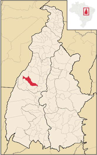
Abreulândia is a municipality located in the Brazilian state of Tocantins. Its population was 2,594 (2020) and its area is 1,895 square kilometres (732 sq mi).
People
Economy
C+Climate
| Population | 2,668 |
| Population Density | 2 / sq mi |
| Elevation | 745 ft (227 m) |
| Coordinates | -9.6214°, -49.1508° |
| Timezone | America/Araguaina |
| Country | 🇧🇷 Brazil |
| State / Province | Tocantins |
| Average Temperature | 78°F (25°C) |
| January Average | 77°F (25°C) |
| July Average | 76°F (24°C) |
| Annual Precipitation | 69.1 inches (1,755 mm) |
| Annual Snowfall | 0.0 inches (0 cm) |
| Median Household Income | $1,920 |
About Abreulândia
Abreulândia is a small town in Brazil (Tocantins) with a population of 2,668. The city sits at an elevation of 745 feet (227 meters) above sea level. The average annual temperature is 78°F (25°C). Temperatures range from 77°F in January to 76°F in July. Annual precipitation averages 69.1 inches. The timezone is America/Araguaina.
Income: Abreulândia vs Brazil
Commute Mode
Income
| Median HH Income | $1,920 |
| 97% below Brazil avg |
Employment & Poverty
| Establishments (County) | 45 |
Business (County)
Tax & Cost of Living
Commute & Transportation
Walkability
Temperature
| Annual Average | 77.5°F |
| 44% above Brazil avg | |
| January Average | 77°F (25°C) |
| July Average | 76°F (24°C) |
| Sunny Days | 211 days/yr |
Geography
| Elevation | 745 ft (227 m) |
| Area | 1,716.3 sq mi (4,445.2 km²) |
| Population Density | 2/sq mi |
| Coordinates | -9.6214°N, 49.1508°W |
| Timezone | America/Araguaina |
Precipitation & Snow
Air Quality
Monthly Weather
| Month | Avg Temperature | Precipitation | Summary |
|---|---|---|---|
| January | 77°F (25°C) | 10.6 in | |
| February | 77°F (25°C) | 10.3 in | |
| March | 78°F (25°C) | 10.7 in | Wettest |
| April | 78°F (25°C) | 6.8 in | |
| May | 77°F (25°C) | 1.7 in | |
| June | 76°F (24°C) | 0.4 in | |
| July | 76°F (24°C) | 0.2 in | Coldest, Driest |
| August | 78°F (26°C) | 0.4 in | |
| September | 80°F (26°C) | 2.4 in | Warmest |
| October | 79°F (26°C) | 6.7 in | |
| November | 78°F (26°C) | 8.4 in | |
| December | 77°F (25°C) | 10.5 in |
Abreulândia has a seasonal temperature swing of 4°F / from 76°F in July to 80°F in September. Total annual precipitation is 69.1 inches, with March being the wettest month (10.7") and July the driest (0.2").
Schools in Abreulândia
2 public schools (NCES 2022-23 data).
| School | Level | Enrollment | Teachers | Student/Teacher |
|---|---|---|---|---|
| Escola Municipal Julio Pinheiro | — | — | — | — |
| Colegio Estadual Sao Pedro | — | — | — | — |
Airports Near Abreulândia
26 airports within the area.
| Airport | IATA | Type |
|---|---|---|
| Agroesser Airport | — | Small Airport |
| Associação Tocantinense de Aviação Airport | — | Small Airport |
| Caiapo Airport | — | Small Airport |
| Carlos da Silveira Bueno Airport | — | Small Airport |
| Dois Irmãos Airstrip | — | Small Airport |
| Dois Irmãos do Tocantins Airstrip | — | Small Airport |
| Fazenda 4 Amigos Airport | — | Small Airport |
| Fazenda Bacaba – JEM Airstrip | — | Small Airport |
| Fazenda Bacaba Airport | — | Small Airport |
| Fazenda Barreiro Airport | — | Small Airport |
| Fazenda Boa Fortuna Airport | — | Small Airport |
| Fazenda Boca da Mata Airport | — | Small Airport |
| Fazenda Nova Fronteira Airport | — | Small Airport |
| Fazenda Palmeiras Airport | — | Small Airport |
| Fazenda Progresso Airstrip | — | Small Airport |
| Fazenda Recanto Airstrip | — | Small Airport |
| Fazenda São Bento Airport | — | Small Airport |
| Fazenda São Geraldo Airport | — | Small Airport |
| Fazenda São João Airport | — | Small Airport |
| Fazenda São Luiz Airport | — | Small Airport |
| Fazenda Vale do Sol II Airstrip | — | Small Airport |
| Fazenda Vale Verde Airport | — | Small Airport |
| Fazenda Veneza Airport | — | Small Airport |
| Franciscus Airport | — | Small Airport |
| GAPS 1 Airport | — | Small Airport |
| Paraíso do Tocantins Airport | — | Small Airport |
Quick Facts
🇧🇷 About Brazil
Public Holidays in Brazil
15 public holidays this year
Download Full City Report
Get a comprehensive, print-ready PDF with all data for Abreulândia.
Get ReportFrequently Asked Questions About Abreulândia
What is the population of Abreulândia?
Abreulândia has a population of 2,668 residents and is located in Brazil. The population density is 2 people per square mile, spread across 1,716.3 square miles.
Is Abreulândia expensive to live in?
The median household income is $1,920, 97% below the national average of $75,149.
What is the weather like in Abreulândia?
Abreulândia has a warm climate with an average annual temperature of 78°F (25°C). Winter temperatures average 77°F in January, while summers reach an average of 76°F in July. The area receives 211 sunny days per year. Annual rainfall totals 69.1 inches.
How is the job market in Abreulândia?
There are 45 business establishments in the area.