Bayramaly, Turkmenistan
Mary · Turkmenistan
Bayramaly is a mid-size city in Mary, Turkmenistan with a population of 70,376. Elevation: 784 ft (239 m). Average temperature: 62°F (17°C).
Population source: Wikidata (dated census and official estimates), GeoNames. Climate: WorldClim 2.1 normals (1970-2000), NASA POWER. Updated August 2026
Discover Bayramaly, Turkmenistan
Explore over 40 sections covering people, economy, housing, health, crime, climate, community, costs, trends, schools, colleges, hospitals, treatment centers, industries, museums, libraries, breweries, farmers markets, grocery stores, pharmacies, campgrounds, parks, trails, stadiums, ski resorts, daycare centers, nursing homes, churches, fire stations, cell towers, bridges, power plants, EV stations, prisons, radio stations, airports, police stations, post offices, Amtrak stations, superfund sites, UNESCO sites, and more.
Use the tabs and dropdown menus below to navigate every data point we track for this city.
About Bayramaly
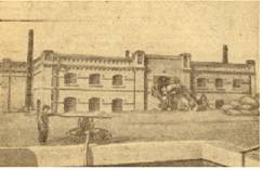
Baýramaly is a city in and the seat of Baýramaly District, Mary Province, Turkmenistan. It lies about 27 km east of the provincial capital Mary, along the main railway line from Ashgabat to Tashkent. In 2022, its population was 70,376.
People
Climate
| Population | 70,376 |
| Population Density | 4,552 / sq mi |
| Elevation | 784 ft (239 m) |
| Coordinates | 37.6185°, 62.1672° |
| Timezone | Asia/Ashgabat |
| Country | 🇹🇲 Turkmenistan |
| State / Province | Mary |
| Average Temperature | 62°F (17°C) |
| January Average | 38°F (3°C) |
| July Average | 87°F (31°C) |
| Annual Precipitation | 6.8 inches (172 mm) |
| Annual Snowfall | 0.0 inches (0 cm) |
About Bayramaly
Bayramaly is a mid-size city in Turkmenistan (Mary) with a population of 70,376. The city sits at an elevation of 784 feet (239 meters) above sea level. The average annual temperature is 62°F (17°C). Temperatures range from 38°F in January to 87°F in July. Annual precipitation averages 6.8 inches. The timezone is Asia/Ashgabat.
Climate in Bayramaly
Bayramaly has an average annual temperature of 17.8°C (64°F). The hottest month is Jul (31.2°C), the coldest is Jan (5°C). Average annual precipitation is 161 mm.
Temperature
| Annual Average | 62.0°F |
| 15% above Turkmenistan avg | |
| January Average | 38°F (3°C) |
| July Average | 87°F (31°C) |
Geography
| Elevation | 784 ft (239 m) |
| Area | 15.5 sq mi (40.0 km²) |
| Population Density | 4,552/sq mi |
| Coordinates | 37.6185°N, 62.1672°E |
| Timezone | Asia/Ashgabat |
Precipitation & Snow
Air Quality
Monthly Weather
| Month | Avg Temperature | Precipitation | Summary |
|---|---|---|---|
| January | 38°F (3°C) | 1.1 in | Coldest |
| February | 41°F (5°C) | 1.0 in | |
| March | 51°F (10°C) | 1.3 in | Wettest |
| April | 65°F (18°C) | 0.9 in | |
| May | 74°F (23°C) | 0.6 in | |
| June | 84°F (29°C) | 0.0 in | |
| July | 87°F (31°C) | 0.0 in | Warmest, Driest |
| August | 83°F (28°C) | 0.0 in | |
| September | 72°F (22°C) | 0.0 in | |
| October | 60°F (16°C) | 0.2 in | |
| November | 50°F (10°C) | 0.5 in | |
| December | 41°F (5°C) | 1.0 in |
Bayramaly has a seasonal temperature swing of 50°F / from 38°F in January to 87°F in July. Total annual precipitation is 6.8 inches, with March being the wettest month (1.3") and July the driest (0.0").
Schools in Bayramaly
13 public schools (OpenStreetMap data).
| School | Level | Enrollment | Teachers | Student/Teacher |
|---|---|---|---|---|
| school 7 | - | - | - | - |
| Secondary School No. 5 | - | - | - | - |
| Secondary School No. 1 | - | - | - | - |
| Secondary School No. 4 | - | - | - | - |
| 8-nji mekdep | - | - | - | - |
| 12-nji mekdep | - | - | - | - |
| Çagalar bagy | - | - | - | - |
| 10-njy mekdep | - | - | - | - |
| 7-nji mekdep | - | - | - | - |
| Sports School | - | - | - | - |
| Secondary School No. 6 | - | - | - | - |
| Baýramaly ş. 9-njy orta mekdebi | - | - | - | - |
| Lisey N-35 | - | - | - | - |
Radio Stations near Bayramaly
0 stations within ~55 km.
| Station | Genre | Quality |
|---|
Museums in Bayramaly
| Name | Type | Address | Phone | Annual Revenue |
|---|---|---|---|---|
| Merv Museum |
Farmers Markets in Bayramaly
| Name | Address | Season | Hours | Organic | Website |
|---|---|---|---|---|---|
| Construction Materials Bazaar | |||||
| Köne bazar | |||||
| Täze bazar |
Restaurants in Bayramaly
6 restaurants within city radius - OpenStreetMap data
Theatres in Bayramaly
1 theatres within city radius - OpenStreetMap data
Monuments in Bayramaly
1 monuments within city radius - OpenStreetMap data
Castles in Bayramaly
1 castles within city radius - OpenStreetMap data
Clinics in Bayramaly
2 clinics within city radius - OpenStreetMap data
Train Stations in Bayramaly
1 train stations within city radius - OpenStreetMap data
Bus Stations in Bayramaly
2 bus stations within city radius - OpenStreetMap data
Gas Stations in Bayramaly
7 gas stations within city radius - OpenStreetMap data
Banks in Bayramaly
3 banks within city radius - OpenStreetMap data
Stadiums & Teams in Bayramaly
| Team | League | Division |
|---|---|---|
Airports Near Bayramaly
2 airports within the area.
| Airport | IATA | Type |
|---|---|---|
| Mary International Airport | MYP | Medium Airport |
| Mary North Airport | - | Medium Airport |
Post Offices in Bayramaly
1 post offices.
| Post Office | Address |
|---|---|
| Poçta |
UNESCO World Heritage Sites Near Bayramaly
1 UNESCO sites.
| Site | Category | Year |
|---|---|---|
| State Historical and Cultural Park “Ancient Merv” | Cultural | 1999 |
Churches & Religious Organizations in Bayramaly
11 religious organizations (IRS tax-exempt data).
| Name | Address |
|---|---|
| Akhmed Zamchi mausoleum complex | |
| Akhmed Zamchi mausoleum complex | |
| Askhab Mausoleum | |
| Beni Makhan Mosque | |
| Buddhist Stupa | |
| Church of St. Alexis, Metropolitan of Moscow | |
| Hoja Ýusup Hemedany gubury | |
| Hoja Ýusup Hemedany Metjidi | |
| Kyz Bibi | |
| Metjid | |
| Mohammed ibn Zayd Mausoleum |
Quick Facts
Around Bayramaly
Places within 5 km radius - OpenStreetMap data
🇹🇲 About Turkmenistan
UNESCO World Heritage Sites Near Bayramaly
Download Full City Report
Get a comprehensive, print-ready PDF with all data for Bayramaly.
Get ReportFrequently Asked Questions About Bayramaly
What is the population of Bayramaly?
Bayramaly has a population of 70,376 residents and is located in Turkmenistan. The population density is 4,552 people per square mile, spread across 15.5 square miles.
What is the weather like in Bayramaly?
Bayramaly enjoys a temperate climate with an average annual temperature of 62°F (17°C). Winter temperatures average 38°F in January, while summers reach an average of 87°F in July. Annual rainfall totals 6.8 inches.
Nearby Cities
Want every data point for Bayramaly?
The full profile puts all sections on one printable page, no tabs.
Full City Profile