 All Countries


Chahal, Guatemala
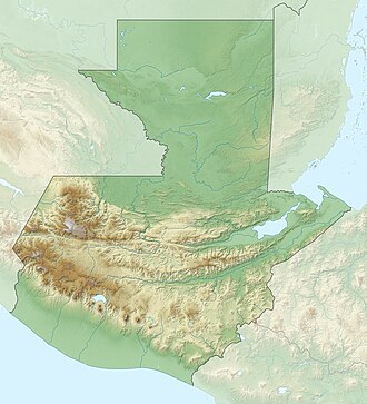
Alta Verapaz · Guatemala
Chahal is a small city in Alta Verapaz, Guatemala with a population of 7,465. Elevation: 584 ft (178 m). Average temperature: 78°F (25°C).
Discover Chahal, Guatemala
Explore over 40 sections covering people, economy, housing, health, crime, climate, community, costs, trends, schools, colleges, hospitals, treatment centers, industries, museums, libraries, breweries, farmers markets, grocery stores, pharmacies, campgrounds, parks, trails, stadiums, ski resorts, daycare centers, nursing homes, churches, fire stations, cell towers, bridges, power plants, EV stations, prisons, radio stations, airports, police stations, post offices, Amtrak stations, superfund sites, UNESCO sites, and more.
Use the tabs and dropdown menus below to navigate every data point we track for this city.
About Chahal
Chahal är en ort i Guatemala. Den ligger i departementet Departamento de Alta Verapaz, i den centrala delen av landet, 160 km nordost om huvudstaden Guatemala City. Chahal Guatemala ligger 174 meter över havet och antalet invånare är 7 465.
People
Climate
| Population | 7,465 |
| Population Density | 31 / sq mi |
| Elevation | 584 ft (178 m) |
| Coordinates | 15.7912°, -89.6052° |
| Timezone | America/Guatemala |
| Country | 🇬🇹 Guatemala |
| State / Province | Alta Verapaz |
| Average Temperature | 78°F (25°C) |
| January Average | 73°F (23°C) |
| July Average | 79°F (26°C) |
| Annual Precipitation | 135.8 inches (3,450 mm) |
| Annual Snowfall | 0.0 inches (0 cm) |
About Chahal
Chahal is a small city in Guatemala (Alta Verapaz) with a population of 7,465. The city sits at an elevation of 584 feet (178 meters) above sea level. The average annual temperature is 78°F (25°C). Temperatures range from 73°F in January to 79°F in July. Annual precipitation averages 135.8 inches. The timezone is America/Guatemala.
Temperature
| Annual Average | 77.6°F |
| 44% above Guatemala avg | |
| January Average | 73°F (23°C) |
| July Average | 79°F (26°C) |
| Sunny Days | 146 days/yr |
Geography
| Elevation | 584 ft (178 m) |
| Area | 237.6 sq mi (615.3 km²) |
| Population Density | 31/sq mi |
| Coordinates | 15.7912°N, 89.6052°W |
| Timezone | America/Guatemala |
Precipitation & Snow
Air Quality
Tsunami History
1 tsunami recorded within 500 km. Highest wave on record: 0.1 m (0 ft).
| Year | Location | Cause | Max Wave | Deaths | Distance |
| 1976 | GUATEMALA | Earthquake | 0.1 m | 23,000 | 75 km |
Nearby Volcanoes
15 volcanoes within 200 km. Closest: Chiquimula Volcanic Field (107 km).
| Name | Type | Elevation | Last Eruption | Distance |
| Chiquimula Volcanic Field | Pyroclastic cone(s) | 1,192 m (3,911 ft) | Unknown | 107 km |
| Ipala | Stratovolcano | 1,650 m (5,413 ft) | Unknown | 138 km |
| Ixtepeque | Lava dome(s) | 1,292 m (4,239 ft) | Unknown | 153 km |
| Tahual | Stratovolcano | 1,716 m (5,630 ft) | Unknown | 155 km |
| Suchitan | Stratovolcano(es) | 2,042 m (6,699 ft) | Unknown | 156 km |
| Santiago, Cerro | Volcanic field | 1,192 m (3,911 ft) | Unknown | 165 km |
| San Diego | Volcanic field | 781 m (2,562 ft) | Unknown | 170 km |
| Flores | Volcanic field | 1,600 m (5,249 ft) | Unknown | 170 km |
| Cuilapa-Barbarena | Volcanic field | 1,454 m (4,770 ft) | Unknown | 184 km |
| Chingo | Stratovolcano | 1,775 m (5,823 ft) | Unknown | 186 km |
| Pacaya | Complex | 2,569 m (8,428 ft) | 2020 | 190 km |
| Agua | Stratovolcano | 3,760 m (12,336 ft) | Unknown | 192 km |
| Singuil, Cerro | Pyroclastic cone(s) | 926 m (3,038 ft) | Unknown | 193 km |
| Yojoa, Lake | Volcanic field | 1,090 m (3,576 ft) | Unknown | 196 km |
| Acatenango | Stratovolcano(es) | 3,976 m (13,045 ft) | 1972 | 198 km |
Monthly Weather
| Month | Avg Temperature | Precipitation | Summary |
|---|---|---|---|
| January | 73°F (23°C) | 6.5 in | Coldest |
| February | 75°F (24°C) | 3.8 in | |
| March | 77°F (25°C) | 4.1 in | |
| April | 80°F (26°C) | 3.7 in | Driest |
| May | 80°F (27°C) | 7.6 in | Warmest |
| June | 80°F (27°C) | 18.0 in | |
| July | 79°F (26°C) | 25.4 in | Wettest |
| August | 79°F (26°C) | 19.8 in | |
| September | 79°F (26°C) | 18.5 in | |
| October | 78°F (25°C) | 13.1 in | |
| November | 75°F (24°C) | 9.4 in | |
| December | 74°F (23°C) | 6.1 in |
Chahal has a seasonal temperature swing of 7°F / from 73°F in January to 80°F in May. Total annual precipitation is 135.8 inches, with July being the wettest month (25.4") and April the driest (3.7").
Hotels in Chahal
1 hotels within city radius — OpenStreetMap data
Airports Near Chahal
7 airports within the area.
| Airport | IATA | Type |
|---|---|---|
| Chisec Airport | — | Small Airport |
| El Estor Airport | — | Small Airport |
| Fray Bartolome Airport | — | Small Airport |
| Las Vegas Airport | LCF | Small Airport |
| Poptún Airport | PON | Small Airport |
| Sayaxché Airport | — | Small Airport |
| Tikindustrias Airport | — | Small Airport |
Quick Facts
🇬🇹 About Guatemala
Public Holidays in Guatemala
13 public holidays this year
Frequently Asked Questions About Chahal
What is the population of Chahal?
Chahal has a population of 7,465 residents and is located in Guatemala. The population density is 31 people per square mile, spread across 237.6 square miles.
What is the weather like in Chahal?
Chahal has a warm climate with an average annual temperature of 78°F (25°C). Winter temperatures average 73°F in January, while summers reach an average of 79°F in July. The area receives 146 sunny days per year, below the national average of 205. Annual rainfall totals 135.8 inches.