 All Countries


Chuchupate, Panama
Chiriquí Province · Panama
Chuchupate is a small town in Chiriquí Province, Panama with a population of 868. Elevation: 72 ft (22 m). Average temperature: 79°F (26°C).
Data updated June 2026
Discover Chuchupate, Panama
Explore over 40 sections covering people, economy, housing, health, crime, climate, community, costs, trends, schools, colleges, hospitals, treatment centers, industries, museums, libraries, breweries, farmers markets, grocery stores, pharmacies, campgrounds, parks, trails, stadiums, ski resorts, daycare centers, nursing homes, churches, fire stations, cell towers, bridges, power plants, EV stations, prisons, radio stations, airports, police stations, post offices, Amtrak stations, superfund sites, UNESCO sites, and more.
Use the tabs and dropdown menus below to navigate every data point we track for this city.
About Chuchupate
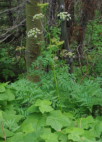
Ligusticum porteri, also known as osha or Porter lovage, is a perennial herb found in parts of the Rocky Mountains and northern New Mexico, in the southwestern United States.
People
Climate
| Population | 868 |
| Population Density | 15 / sq mi |
| Elevation | 72 ft (22 m) |
| Coordinates | 8.4359°, -82.8622° |
| Timezone | America/Panama |
| Country | 🇵🇦 Panama |
| State / Province | Chiriquí Province |
| Average Temperature | 79°F (26°C) |
| January Average | 78°F (26°C) |
| July Average | 79°F (26°C) |
| Annual Precipitation | 128.0 inches (3,250 mm) |
| Annual Snowfall | 0.0 inches (0 cm) |
About Chuchupate
Chuchupate is a small town in Panama (Chiriquí Province) with a population of 868. The city sits at an elevation of 72 feet (22 meters) above sea level. The average annual temperature is 79°F (26°C). Temperatures range from 78°F in January to 79°F in July. Annual precipitation averages 128.0 inches. The timezone is America/Panama.
Temperature
| Annual Average | 79.0°F |
| 46% above Panama avg | |
| January Average | 78°F (26°C) |
| July Average | 79°F (26°C) |
| Sunny Days | 138 days/yr |
Geography
| Elevation | 72 ft (22 m) |
| Area | 56.7 sq mi (146.8 km²) |
| Population Density | 15/sq mi |
| Coordinates | 8.4359°N, 82.8622°W |
| Timezone | America/Panama |
Precipitation & Snow
Air Quality
Tsunami History
8 tsunamis recorded within 500 km. Highest wave on record: 3.0 m (10 ft).
| Year | Location | Cause | Max Wave | Deaths | Distance |
| 1991 | LIMON, PANDORA | Earthquake | 3.0 m | 90 | 141 km |
| 1934 | COSTA RICA-PANAMA | Earthquake | 0.3 m | — | 63 km |
| 1941 | COSTA RICA-PANAMA | Earthquake | 0.2 m | 6 | 47 km |
| 1983 | COSTA RICA | Earthquake | 0.1 m | 6 | 37 km |
| 1941 | COSTA RICA-PANAMA | Earthquake | 0.1 m | — | 125 km |
| 1962 | COSTA RICA-PANAMA | Earthquake | 0.1 m | — | 49 km |
| 1854 | COSTA RICA-PANAMA | Eruption + Earthquake | — | — | 17 km |
| 1822 | MATINA | Earthquake | — | — | 119 km |
Monthly Weather
| Month | Avg Temperature | Precipitation | Summary |
|---|---|---|---|
| January | 78°F (26°C) | 2.4 in | |
| February | 79°F (26°C) | 2.3 in | Driest |
| March | 81°F (27°C) | 3.4 in | |
| April | 81°F (27°C) | 7.1 in | Warmest |
| May | 81°F (27°C) | 13.9 in | |
| June | 79°F (26°C) | 13.7 in | |
| July | 79°F (26°C) | 13.0 in | |
| August | 79°F (26°C) | 14.4 in | |
| September | 78°F (26°C) | 15.5 in | |
| October | 78°F (26°C) | 22.1 in | Wettest |
| November | 77°F (25°C) | 14.8 in | Coldest |
| December | 78°F (25°C) | 5.4 in |
Chuchupate has a seasonal temperature swing of 4°F / from 77°F in November to 81°F in April. Total annual precipitation is 128.0 inches, with October being the wettest month (22.1") and February the driest (2.3").
Radio Stations near Chuchupate
1 stations within ~55 km.
| Station | Genre | Quality | |
|---|---|---|---|
| CHT FM 107.7 | entretenimiento, musica | MP3 96 kbps |
Libraries in Chuchupate
| Name | Address | Staff | Annual Visits | Circulation | Collection | Programs |
|---|---|---|---|---|---|---|
| Biblioteca Pública | 0.0 | |||||
| Farmacia Herrera | 0.0 | |||||
| Generosa Valdés | 0.0 |
Farmers Markets in Chuchupate
| Name | Address | Season | Hours | Organic | Website |
|---|---|---|---|---|---|
| Mercado Municipal de Corredores | |||||
| Refrescos Enil |
Stadiums & Teams in Chuchupate
| Team | League | Division |
|---|---|---|
Airports Near Chuchupate
25 airports within the area.
| Airport | IATA | Type |
|---|---|---|
| Buenos Aires Airport | BAI | Medium Airport |
| Coto 47 Airport | OTR | Medium Airport |
| Enrique Malek International Airport | DAV | Medium Airport |
| Golfito Airport | GLF | Medium Airport |
| Palmar Sur Airport | PMZ | Medium Airport |
| Puerto Jimenez Airport | PJM | Medium Airport |
| Alvaro Berroa Airport | — | Small Airport |
| Cangrejo Verde Airport | — | Small Airport |
| Carate Airport | — | Small Airport |
| Dieciocho Airport | — | Small Airport |
| Finca 10 / Nuevo Palmar Sur Airport | — | Small Airport |
| Finca 63 (Coto 63) Airport | — | Small Airport |
| Finca Blanco Airport | — | Small Airport |
| Finca Ceiba Airport | — | Small Airport |
| Finca Delicias Airport | — | Small Airport |
| Finca Fátima Airport | — | Small Airport |
| La Cabezona Airport | — | Small Airport |
| Laurel Airport | — | Small Airport |
| Potrero Grande Airfield | — | Small Airport |
| Puerto Armuelles Airport | AML | Small Airport |
| Punta Banco Airport | — | Small Airport |
| Rancho del Mar Airport | — | Small Airport |
| Salama Airport | — | Small Airport |
| San Vito de Java Airport | TOO | Small Airport |
| Sirena Airport | — | Small Airport |
Quick Facts
🇵🇦 About Panama
Public Holidays in Panama
13 public holidays this year
Download Full City Report
Get a comprehensive, print-ready PDF with all data for Chuchupate.
Get ReportFrequently Asked Questions About Chuchupate
What is the population of Chuchupate?
Chuchupate has a population of 868 residents and is located in Panama. The population density is 15 people per square mile, spread across 56.7 square miles.
What is the weather like in Chuchupate?
Chuchupate has a warm climate with an average annual temperature of 79°F (26°C). Winter temperatures average 78°F in January, while summers reach an average of 79°F in July. The area receives 138 sunny days per year, below the national average of 205. Annual rainfall totals 128.0 inches.