 All Countries


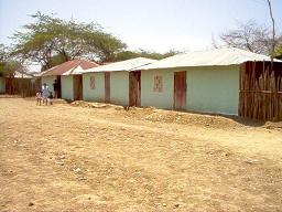
Concordia, Colombia
Magdalena Department · Colombia
Concordia is a small city in Magdalena Department, Colombia with a population of 6,624. Elevation: 453 ft (138 m). Average temperature: 82°F (28°C).
Data updated June 2026
Discover Concordia, Colombia
Explore over 40 sections covering people, economy, housing, health, crime, climate, community, costs, trends, schools, colleges, hospitals, treatment centers, industries, museums, libraries, breweries, farmers markets, grocery stores, pharmacies, campgrounds, parks, trails, stadiums, ski resorts, daycare centers, nursing homes, churches, fire stations, cell towers, bridges, power plants, EV stations, prisons, radio stations, airports, police stations, post offices, Amtrak stations, superfund sites, UNESCO sites, and more.
Use the tabs and dropdown menus below to navigate every data point we track for this city.
About Concordia
Concordia is a town and municipality of the Magdalena Department in northern Colombia. Founded by Mandate 007 of June 24, 1999 with portion of territories from the municipalities of Cerro San Antonio and Pedraza.
People
Climate
| Population | 6,624 |
| Population Density | 17 / sq mi |
| Elevation | 453 ft (138 m) |
| Coordinates | 9.8355°, -74.4555° |
| Timezone | America/Bogota |
| Country | 🇨🇴 Colombia |
| State / Province | Magdalena Department |
| Average Temperature | 82°F (28°C) |
| January Average | 81°F (27°C) |
| July Average | 82°F (28°C) |
| Annual Precipitation | 54.3 inches (1,380 mm) |
| Annual Snowfall | 0.0 inches (0 cm) |
About Concordia
Concordia is a small city in Colombia (Magdalena Department) with a population of 6,624. The city sits at an elevation of 453 feet (138 meters) above sea level. The average annual temperature is 82°F (28°C). Temperatures range from 81°F in January to 82°F in July. Annual precipitation averages 54.3 inches. The timezone is America/Bogota.
Temperature
| Annual Average | 81.6°F |
| 51% above Colombia avg | |
| January Average | 81°F (27°C) |
| July Average | 82°F (28°C) |
| Sunny Days | 237 days/yr |
Geography
| Elevation | 453 ft (138 m) |
| Area | 387.1 sq mi (1,002.5 km²) |
| Population Density | 17/sq mi |
| Coordinates | 9.8355°N, 74.4555°W |
| Timezone | America/Bogota |
Precipitation & Snow
Air Quality
Tsunami History
1 tsunami recorded within 500 km. Highest wave on record: 8.0 m (26 ft).
| Year | Location | Cause | Max Wave | Deaths | Distance |
| 2017 | OFF THE COAST NEAR SANTA MARTA | Unknown | 8.0 m | — | 131 km |
Monthly Weather
| Month | Avg Temperature | Precipitation | Summary |
|---|---|---|---|
| January | 81°F (27°C) | 0.7 in | Driest |
| February | 83°F (28°C) | 0.9 in | |
| March | 83°F (29°C) | 1.3 in | Warmest |
| April | 83°F (28°C) | 4.4 in | |
| May | 82°F (28°C) | 6.7 in | |
| June | 82°F (28°C) | 6.2 in | |
| July | 82°F (28°C) | 5.1 in | |
| August | 82°F (28°C) | 6.3 in | |
| September | 81°F (27°C) | 7.8 in | |
| October | 80°F (27°C) | 8.3 in | Coldest, Wettest |
| November | 80°F (27°C) | 5.1 in | |
| December | 81°F (27°C) | 1.5 in |
Concordia has a seasonal temperature swing of 3°F / from 80°F in October to 83°F in March. Total annual precipitation is 54.3 inches, with October being the wettest month (8.3") and January the driest (0.7").
Airports Near Concordia
25 airports within the area.
| Airport | IATA | Type |
|---|---|---|
| Baracoa Airport | MGN | Medium Airport |
| Algarrobo Airport | — | Small Airport |
| Bethania Airport | — | Small Airport |
| Carmen De Bolivar Airport | — | Small Airport |
| Chivolo Airport | IVO | Small Airport |
| Cicuco Airport | — | Small Airport |
| Corral Nuevo Airport | — | Small Airport |
| El Carmen Airport | — | Small Airport |
| El Coraje Airport | — | Small Airport |
| El Edén Airport | — | Small Airport |
| El Esfuerzo Airport | — | Small Airport |
| Fundación Airport | FDA | Small Airport |
| Guamal Airport | GAA | Small Airport |
| Hacienda Veracruz Airport | — | Small Airport |
| Julia Carolina Airport | — | Small Airport |
| La Fe Airport | — | Small Airport |
| La Gaviota Airport | — | Small Airport |
| La Palma Airport | — | Small Airport |
| La Vega Airport | — | Small Airport |
| Mayorca Airport | — | Small Airport |
| Monterrey Airport | — | Small Airport |
| Plato Airport | PLT | Small Airport |
| San Bernardo Airport | MMP | Small Airport |
| San Martin Airport | — | Small Airport |
| San Pedro Airport | — | Small Airport |
Quick Facts
🇨🇴 About Colombia
Public Holidays in Colombia
18 public holidays this year
Download Full City Report
Get a comprehensive, print-ready PDF with all data for Concordia.
Get ReportFrequently Asked Questions About Concordia
What is the population of Concordia?
Concordia has a population of 6,624 residents and is located in Colombia. The population density is 17 people per square mile, spread across 387.1 square miles.
What is the weather like in Concordia?
Concordia has a warm climate with an average annual temperature of 82°F (28°C). Winter temperatures average 81°F in January, while summers reach an average of 82°F in July. The area receives 237 sunny days per year. Annual rainfall totals 54.3 inches.