 All Countries


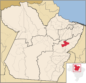
Goianésia do Pará, Brazil
Pará · Brazil
Goianésia do Pará is a small city in Pará, Brazil with a population of 26,362. Elevation: 338 ft (103 m). Average temperature: 80°F (27°C).
Discover Goianésia do Pará, Brazil
Explore over 40 sections covering people, economy, housing, health, crime, climate, community, costs, trends, schools, colleges, hospitals, treatment centers, industries, museums, libraries, breweries, farmers markets, grocery stores, pharmacies, campgrounds, parks, trails, stadiums, ski resorts, daycare centers, nursing homes, churches, fire stations, cell towers, bridges, power plants, EV stations, prisons, radio stations, airports, police stations, post offices, Amtrak stations, superfund sites, UNESCO sites, and more.
Use the tabs and dropdown menus below to navigate every data point we track for this city.
About Goianésia do Pará
Goianésia do Pará is a municipality, and municipal seat in the state of Pará, Brazil. In 2020 the population was 41,081. The municipal area is 7,024 km2. The city of Goianésia do Pará is approximately 103 m above sea level.
People
Economy
C+Climate
| Population | 26,362 |
| Population Density | 7 / sq mi |
| Elevation | 338 ft (103 m) |
| Coordinates | -3.8425°, -49.0969° |
| Timezone | America/Belem |
| Country | 🇧🇷 Brazil |
| State / Province | Pará |
| Average Temperature | 80°F (27°C) |
| January Average | 79°F (26°C) |
| July Average | 80°F (27°C) |
| Annual Precipitation | 84.5 inches (2,145 mm) |
| Annual Snowfall | 0.0 inches (0 cm) |
| Median Household Income | $1,440 |
About Goianésia do Pará
Goianésia do Pará is a small city in Brazil (Pará) with a population of 26,362. The city sits at an elevation of 338 feet (103 meters) above sea level. The average annual temperature is 80°F (27°C). Temperatures range from 79°F in January to 80°F in July. Annual precipitation averages 84.5 inches. The timezone is America/Belem.
Income: Goianésia do Pará vs Brazil
Commute Mode
Income
| Median HH Income | $1,440 |
| 98% below Brazil avg |
Employment & Poverty
| Establishments (County) | 448 |
Business (County)
Tax & Cost of Living
Commute & Transportation
Walkability
Climate in Goianésia do Pará
Goianésia do Pará has an average annual temperature of 27.6°C (82°F). The hottest month is Sep (30.7°C), the coldest is Mar (25.8°C). Average annual precipitation is 1734 mm.
Temperature
| Annual Average | 79.7°F |
| 48% above Brazil avg | |
| January Average | 79°F (26°C) |
| July Average | 80°F (27°C) |
| Sunny Days | 192 days/yr |
Geography
| Elevation | 338 ft (103 m) |
| Area | 3,702.4 sq mi (9,589.2 km²) |
| Population Density | 7/sq mi |
| Coordinates | -3.8425°N, 49.0969°W |
| Timezone | America/Belem |
Precipitation & Snow
Air Quality
Monthly Weather
| Month | Avg Temperature | Precipitation | Summary |
|---|---|---|---|
| January | 79°F (26°C) | 12.1 in | |
| February | 78°F (26°C) | 14.5 in | Coldest |
| March | 78°F (26°C) | 15.5 in | Wettest |
| April | 79°F (26°C) | 13.3 in | |
| May | 80°F (27°C) | 7.3 in | |
| June | 80°F (27°C) | 2.8 in | |
| July | 80°F (27°C) | 1.6 in | |
| August | 80°F (27°C) | 1.3 in | Driest |
| September | 81°F (27°C) | 1.5 in | Warmest |
| October | 81°F (27°C) | 3.0 in | |
| November | 80°F (27°C) | 4.2 in | |
| December | 80°F (27°C) | 7.5 in |
Goianésia do Pará has a seasonal temperature swing of 3°F / from 78°F in February to 81°F in September. Total annual precipitation is 84.5 inches, with March being the wettest month (15.5") and August the driest (1.3").
Schools in Goianésia do Pará
1 public schools (NCES 2022-23 data).
| School | Level | Enrollment | Teachers | Student/Teacher |
|---|---|---|---|---|
| Conselhos de Goianésia | — | — | — | — |
Hotels in Goianésia do Pará
1 hotels within city radius — OpenStreetMap data
Bus Stations in Goianésia do Pará
2 bus stations within city radius — OpenStreetMap data
Gas Stations in Goianésia do Pará
4 gas stations within city radius — OpenStreetMap data
Gyms in Goianésia do Pará
1 gyms within city radius — OpenStreetMap data
Airports Near Goianésia do Pará
15 airports within the area.
| Airport | IATA | Type |
|---|---|---|
| Tucuruí Airport | TUR | Medium Airport |
| Agro Fazollo Airport | — | Small Airport |
| Codenorte Airport | — | Small Airport |
| Fazenda Boa Esperança I Airport | — | Small Airport |
| Fazenda Cajueiro Airport | — | Small Airport |
| Fazenda Capim Airstrip | — | Small Airport |
| Fazenda Cikel Airport | — | Small Airport |
| Fazenda Estrela Dalva Airport | — | Small Airport |
| Fazenda Nápoles Airport | — | Small Airport |
| Fazenda Rio Capim Airport | — | Small Airport |
| Fazenda Santo Antônio Airport | — | Small Airport |
| Fazenda São Geraldo II Airstrip | — | Small Airport |
| Fazenda Vitória Airport | — | Small Airport |
| Mara Rosa Airport | — | Small Airport |
| Marina do Caraipé Airport | — | Small Airport |
Quick Facts
🇧🇷 About Brazil
Public Holidays in Brazil
15 public holidays this year
Download Full City Report
Get a comprehensive, print-ready PDF with all data for Goianésia do Pará.
Get ReportFrequently Asked Questions About Goianésia do Pará
What is the population of Goianésia do Pará?
Goianésia do Pará has a population of 26,362 residents and is located in Brazil. The population density is 7 people per square mile, spread across 3,702.4 square miles.
Is Goianésia do Pará expensive to live in?
The median household income is $1,440, 98% below the national average of $75,149.
What is the weather like in Goianésia do Pará?
Goianésia do Pará has a warm climate with an average annual temperature of 80°F (27°C). Winter temperatures average 79°F in January, while summers reach an average of 80°F in July. The area receives 192 sunny days per year. Annual rainfall totals 84.5 inches.
How is the job market in Goianésia do Pará?
There are 448 business establishments in the area.