 All Countries


Kapiri Mposhi, Zambia
Central Province · Zambia
Kapiri Mposhi is a mid-size city in Central Province, Zambia with a population of 83,211. Elevation: 4,150 ft (1,265 m). Average temperature: 68°F (20°C).
Data updated June 2026
Discover Kapiri Mposhi, Zambia
Explore over 40 sections covering people, economy, housing, health, crime, climate, community, costs, trends, schools, colleges, hospitals, treatment centers, industries, museums, libraries, breweries, farmers markets, grocery stores, pharmacies, campgrounds, parks, trails, stadiums, ski resorts, daycare centers, nursing homes, churches, fire stations, cell towers, bridges, power plants, EV stations, prisons, radio stations, airports, police stations, post offices, Amtrak stations, superfund sites, UNESCO sites, and more.
Use the tabs and dropdown menus below to navigate every data point we track for this city.
About Kapiri Mposhi
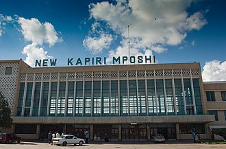
Kapiri Mposhi is a Zambian town and the seat of the Kapiri Mposhi District in Central Province. Located north of Lusaka, it stands on the Great North Road and is significant for the railway connection between the Zambia Railways line from Kitwe to Lusaka and the western terminus of the Tanzania-Zambia Railway Authority from Dar es Salaam since 1976.
People
Climate
| Population | 83,211 |
| Population Density | 18 / sq mi |
| Elevation | 4,150 ft (1,265 m) |
| Coordinates | -13.9715°, 28.6699° |
| Timezone | Africa/Lusaka |
| Country | 🇿🇲 Zambia |
| State / Province | Central Province |
| Average Temperature | 68°F (20°C) |
| January Average | 71°F (21°C) |
| July Average | 60°F (15°C) |
| Annual Precipitation | 39.5 inches (1,004 mm) |
| Annual Snowfall | 0.0 inches (0 cm) |
About Kapiri Mposhi
Kapiri Mposhi is a mid-size city in Zambia (Central Province) with a population of 83,211. The city sits at an elevation of 4,150 feet (1,265 meters) above sea level. The average annual temperature is 68°F (20°C). Temperatures range from 71°F in January to 60°F in July. Annual precipitation averages 39.5 inches. The timezone is Africa/Lusaka.
Climate in Kapiri Mposhi
Kapiri Mposhi has an average annual temperature of 20.7°C (69°F). The hottest month is Oct (25.3°C), the coldest is Jul (15.9°C). Average annual precipitation is 1146 mm.
Temperature
| Annual Average | 68.2°F |
| 26% above Zambia avg | |
| January Average | 71°F (21°C) |
| July Average | 60°F (15°C) |
| Sunny Days | 264 days/yr |
Geography
| Elevation | 4,150 ft (1,265 m) |
| Area | 4,748.8 sq mi (12,299.4 km²) |
| Population Density | 18/sq mi |
| Coordinates | -13.9715°N, 28.6699°W |
| Timezone | Africa/Lusaka |
Precipitation & Snow
Air Quality
Monthly Weather
| Month | Avg Temperature | Precipitation | Summary |
|---|---|---|---|
| January | 71°F (21°C) | 9.6 in | |
| February | 71°F (21°C) | 8.6 in | |
| March | 70°F (21°C) | 5.2 in | |
| April | 68°F (20°C) | 1.3 in | |
| May | 64°F (18°C) | 0.2 in | |
| June | 60°F (15°C) | 0.0 in | Coldest, Driest |
| July | 60°F (15°C) | 0.0 in | |
| August | 64°F (18°C) | 0.0 in | |
| September | 71°F (22°C) | 0.0 in | |
| October | 75°F (24°C) | 0.8 in | Warmest |
| November | 74°F (23°C) | 4.1 in | |
| December | 71°F (22°C) | 9.7 in | Wettest |
Kapiri Mposhi has a seasonal temperature swing of 15°F / from 60°F in June to 75°F in October. Total annual precipitation is 39.5 inches, with December being the wettest month (9.7") and June the driest (0.0").
Schools in Kapiri Mposhi
42 public schools (NCES 2022-23 data).
| School | Level | Enrollment | Teachers | Student/Teacher |
|---|---|---|---|---|
| Twalumba Community School | — | — | — | — |
| Ebenezer Pre & Primary School | — | — | — | — |
| Lady Academy | — | — | — | — |
| Gilgal Christian Academy | — | — | — | — |
| Mummy's Daycare School | — | — | — | — |
| Jesus Care Ministries School | — | — | — | — |
| Kapiri Modern School | — | — | — | — |
| Kapiri Girls Technical School | — | — | — | — |
| Aunty Getrude Community School | — | — | — | — |
| Munshimbili Primary School | — | — | — | — |
| Little Angels School | — | — | — | — |
| Shalom Primary School | — | — | — | — |
| Daknam School | — | — | — | — |
| Chibele Primary School | — | — | — | — |
| Prince Of Peace School | — | — | — | — |
| Fyabana Early Childhood And Primary School | — | — | — | — |
| Grace Academy | — | — | — | — |
| Kapiri College | — | — | — | — |
| Shalom Primary School | — | — | — | — |
| Ebenezer Pre & Primary School | — | — | — | — |
| Kapiri Modern School | — | — | — | — |
| Chilekwa School | — | — | — | — |
| Shipungu Community School | — | — | — | — |
| Kalulu School | — | — | — | — |
| St. Philomina College Of Education | — | — | — | — |
| Chawanga Academy | — | — | — | — |
| Aunty Getrude Community School | — | — | — | — |
| Munshimbili Primary School | — | — | — | — |
| Little Angels School | — | — | — | — |
| Twalumba Community School | — | — | — | — |
| John Paul II Secondary | — | — | — | — |
| Charitable Christian School | — | — | — | — |
| Angeles Park School | — | — | — | — |
| Lukanda B School | — | — | — | — |
| Chisekela Balanda A Child In Distress School | — | — | — | — |
| Daknam School | — | — | — | — |
| Chibele Primary School | — | — | — | — |
| Prince Of Peace School | — | — | — | — |
| Fyabana Early Childhood And Primary School | — | — | — | — |
| Grace Academy | — | — | — | — |
| Kapiri College | — | — | — | — |
| Clayton School | — | — | — | — |
Hotels in Kapiri Mposhi
3 hotels within city radius — OpenStreetMap data
Clinics in Kapiri Mposhi
5 clinics within city radius — OpenStreetMap data
Veterinaries in Kapiri Mposhi
11 veterinaries within city radius — OpenStreetMap data
Train Stations in Kapiri Mposhi
3 train stations within city radius — OpenStreetMap data
Bus Stations in Kapiri Mposhi
1 bus stations within city radius — OpenStreetMap data
Gas Stations in Kapiri Mposhi
8 gas stations within city radius — OpenStreetMap data
Airports Near Kapiri Mposhi
4 airports within the area.
| Airport | IATA | Type |
|---|---|---|
| Amelia Airport | — | Small Airport |
| Chiwala Airport | — | Small Airport |
| Milliken Airport | — | Small Airport |
| Mkushi Airport | — | Small Airport |
Quick Facts
Around Kapiri Mposhi
Places within 5 km radius — OpenStreetMap data
🇿🇲 About Zambia
Download Full City Report
Get a comprehensive, print-ready PDF with all data for Kapiri Mposhi.
Get ReportFrequently Asked Questions About Kapiri Mposhi
What is the population of Kapiri Mposhi?
Kapiri Mposhi has a population of 83,211 residents and is located in Zambia. The population density is 18 people per square mile, spread across 4,748.8 square miles.
What is the weather like in Kapiri Mposhi?
Kapiri Mposhi enjoys a temperate climate with an average annual temperature of 68°F (20°C). Winter temperatures average 71°F in January, while summers reach an average of 60°F in July. The area receives 264 sunny days per year, well above the national average of 205. Annual rainfall totals 39.5 inches.