 All Countries


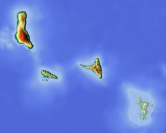
Milévani, Comoros
Grande Comore · Comoros
Milévani is a small town in Grande Comore, Comoros with a population of 729. Elevation: 781 ft (238 m). Average temperature: 79°F (26°C).
Data updated June 2026
Discover Milévani, Comoros
Explore over 40 sections covering people, economy, housing, health, crime, climate, community, costs, trends, schools, colleges, hospitals, treatment centers, industries, museums, libraries, breweries, farmers markets, grocery stores, pharmacies, campgrounds, parks, trails, stadiums, ski resorts, daycare centers, nursing homes, churches, fire stations, cell towers, bridges, power plants, EV stations, prisons, radio stations, airports, police stations, post offices, Amtrak stations, superfund sites, UNESCO sites, and more.
Use the tabs and dropdown menus below to navigate every data point we track for this city.
About Milévani
Milévani är en ort i Komorerna. Den ligger i distriktet Grande Comore, i den nordvästra delen av landet, 17 km norr om huvudstaden Moroni. Milévani ligger 164 meter över havet och antalet invånare är 729. Den ligger på ön Grande Comore.
People
Climate
| Population | 729 |
| Population Density | 48 / sq mi |
| Elevation | 781 ft (238 m) |
| Coordinates | -11.5549°, 43.2976° |
| Timezone | Indian/Comoro |
| Country | 🇰🇲 Comoros |
| State / Province | Grande Comore |
| Average Temperature | 79°F (26°C) |
| January Average | 80°F (27°C) |
| July Average | 77°F (25°C) |
| Annual Precipitation | 47.6 inches (1,209 mm) |
| Annual Snowfall | 0.0 inches (0 cm) |
About Milévani
Milévani is a small town in Comoros (Grande Comore) with a population of 729. The city sits at an elevation of 781 feet (238 meters) above sea level. The average annual temperature is 79°F (26°C). Temperatures range from 80°F in January to 77°F in July. Annual precipitation averages 47.6 inches. The timezone is Indian/Comoro.
Temperature
| Annual Average | 79.3°F |
| 47% above Comoros avg | |
| January Average | 80°F (27°C) |
| July Average | 77°F (25°C) |
| Sunny Days | 360 days/yr |
Geography
| Elevation | 781 ft (238 m) |
| Area | 15.3 sq mi (39.7 km²) |
| Population Density | 48/sq mi |
| Coordinates | -11.5549°N, 43.2976°W |
| Timezone | Indian/Comoro |
Precipitation & Snow
Air Quality
Nearby Volcanoes
1 volcano within 200 km. Closest: Karthala (24 km).
| Name | Type | Elevation | Last Eruption | Distance |
| Karthala | Shield | 2,361 m (7,746 ft) | 2007 | 24 km |
Monthly Weather
| Month | Avg Temperature | Precipitation | Summary |
|---|---|---|---|
| January | 80°F (27°C) | 14.3 in | Warmest, Wettest |
| February | 78°F (26°C) | 10.9 in | |
| March | 78°F (26°C) | 10.7 in | |
| April | 77°F (25°C) | 12.1 in | |
| May | 76°F (25°C) | 9.3 in | |
| June | 74°F (23°C) | 7.3 in | |
| July | 77°F (25°C) | 7.0 in | |
| August | 72°F (22°C) | 4.5 in | Coldest |
| September | 73°F (23°C) | 2.1 in | Driest |
| October | 75°F (24°C) | 3.8 in | |
| November | 77°F (25°C) | 4.2 in | |
| December | 78°F (25°C) | 7.9 in |
Milévani has a seasonal temperature swing of 8°F / from 72°F in August to 80°F in January. Total annual precipitation is 93.9 inches, with January being the wettest month (14.3") and September the driest (2.1").
Museums in Milévani
| Name | Type | Address | Phone | Annual Revenue |
|---|---|---|---|---|
| Bangwe Kuyu | ||||
| Musée des Comores |
Libraries in Milévani
| Name | Address | Staff | Annual Visits | Circulation | Collection | Programs |
|---|---|---|---|---|---|---|
| Centre culturel Toimaya Ya Maoudou | 0.0 | |||||
| Centre culturel UDSCEM | 0.0 | |||||
| Foyer Fahar | 0.0 |
Farmers Markets in Milévani
| Name | Address | Season | Hours | Organic | Website |
|---|---|---|---|---|---|
| 2éme marché | |||||
| Ancien marché de Moroni | |||||
| Boutique | |||||
| Le Grand Marché Couvert Volovolo | |||||
| Marché | |||||
| marche | |||||
| Marché des femmes | |||||
| Marché Mlimantsini | |||||
| Marché Oussivo | |||||
| Marché Pareni | |||||
| Marché Public | |||||
| marché public | |||||
| Marché Sirkali Ya Djuwu | |||||
| Marchée Publique | |||||
| Sara |
Hotels in Milévani
1 hotels within city radius — OpenStreetMap data
Restaurants in Milévani
3 restaurants within city radius — OpenStreetMap data
Cafes in Milévani
1 cafes within city radius — OpenStreetMap data
Gas Stations in Milévani
1 gas stations within city radius — OpenStreetMap data
Banks in Milévani
1 banks within city radius — OpenStreetMap data
Stadiums & Teams in Milévani
| Team | League | Division |
|---|---|---|
Airports Near Milévani
2 airports within the area.
| Airport | IATA | Type |
|---|---|---|
| Prince Said Ibrahim International Airport | HAH | Large Airport |
| Mohéli Bandar Es Eslam Airport | NWA | Medium Airport |
Churches & Religious Organizations in Milévani
6 religious organizations (IRS tax-exempt data).
| Name | Address |
|---|---|
| Ancien Mosquée | |
| Grande Mosquée | |
| Mosquée de Mbaléni | |
| Mosquée Diboini | |
| Mosquée Saana | |
| Mosquée volovolo |
Quick Facts
🇰🇲 About Comoros
Download Full City Report
Get a comprehensive, print-ready PDF with all data for Milévani.
Get ReportFrequently Asked Questions About Milévani
What is the population of Milévani?
Milévani has a population of 729 residents and is located in Comoros. The population density is 48 people per square mile, spread across 15.3 square miles.
What is the weather like in Milévani?
Milévani has a warm climate with an average annual temperature of 79°F (26°C). Winter temperatures average 80°F in January, while summers reach an average of 77°F in July. The area receives 360 sunny days per year, well above the national average of 205. Annual rainfall totals 47.6 inches.