 All Countries


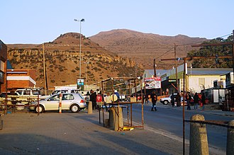
Mohale's Hoek, Lesotho
Mohale's Hoek District · Lesotho
Mohale's Hoek is a mid-size city in Mohale's Hoek District, Lesotho with a population of 46,593. Elevation: 5,243 ft (1,598 m). Average temperature: 60°F (15°C).
Discover Mohale's Hoek, Lesotho
Explore over 40 sections covering people, economy, housing, health, crime, climate, community, costs, trends, schools, colleges, hospitals, treatment centers, industries, museums, libraries, breweries, farmers markets, grocery stores, pharmacies, campgrounds, parks, trails, stadiums, ski resorts, daycare centers, nursing homes, churches, fire stations, cell towers, bridges, power plants, EV stations, prisons, radio stations, airports, police stations, post offices, Amtrak stations, superfund sites, UNESCO sites, and more.
Use the tabs and dropdown menus below to navigate every data point we track for this city.
About Mohale's Hoek
Mohale's Hoek is the capital city of Mohale's Hoek District in Lesotho. It had a population of approximately 40,040 in 2016.
People
Climate
| Population | 46,593 |
| Population Density | 19 / sq mi |
| Elevation | 5,243 ft (1,598 m) |
| Coordinates | -30.1514°, 27.4769° |
| Timezone | Africa/Maseru |
| Country | 🇱🇸 Lesotho |
| State / Province | Mohale's Hoek District |
| Average Temperature | 60°F (15°C) |
| January Average | 71°F (21°C) |
| July Average | 46°F (8°C) |
| Annual Precipitation | 26.1 inches (662 mm) |
| Annual Snowfall | 0.0 inches (0 cm) |
About Mohale's Hoek
Mohale's Hoek is a mid-size city in Lesotho (Mohale's Hoek District) with a population of 46,593. The city sits at an elevation of 5,243 feet (1,598 meters) above sea level. The average annual temperature is 60°F (15°C). Temperatures range from 71°F in January to 46°F in July. Annual precipitation averages 26.1 inches. The timezone is Africa/Maseru.
Climate in Mohale's Hoek
Mohale's Hoek has an average annual temperature of 13.9°C (57°F). The hottest month is Jan (20.2°C), the coldest is Jul (5.4°C). Average annual precipitation is 674 mm.
Temperature
| Annual Average | 59.5°F |
| 10% above Lesotho avg | |
| January Average | 71°F (21°C) |
| July Average | 46°F (8°C) |
| Sunny Days | 289 days/yr |
Geography
| Elevation | 5,243 ft (1,598 m) |
| Area | 2,411.8 sq mi (6,246.5 km²) |
| Population Density | 19/sq mi |
| Coordinates | -30.1514°N, 27.4769°W |
| Timezone | Africa/Maseru |
Precipitation & Snow
Air Quality
Monthly Weather
| Month | Avg Temperature | Precipitation | Summary |
|---|---|---|---|
| January | 71°F (21°C) | 3.8 in | Warmest |
| February | 69°F (21°C) | 4.1 in | Wettest |
| March | 66°F (19°C) | 3.6 in | |
| April | 59°F (15°C) | 2.0 in | |
| May | 52°F (11°C) | 0.8 in | |
| June | 46°F (8°C) | 0.6 in | |
| July | 46°F (8°C) | 0.4 in | Coldest, Driest |
| August | 51°F (11°C) | 0.9 in | |
| September | 57°F (14°C) | 1.3 in | |
| October | 63°F (17°C) | 2.6 in | |
| November | 66°F (19°C) | 3.0 in | |
| December | 69°F (21°C) | 3.0 in |
Mohale's Hoek has a seasonal temperature swing of 25°F / from 46°F in July to 71°F in January. Total annual precipitation is 26.1 inches, with February being the wettest month (4.1") and July the driest (0.4").
Schools in Mohale's Hoek
36 public schools (NCES 2022-23 data).
| School | Level | Enrollment | Teachers | Student/Teacher |
|---|---|---|---|---|
| 'Maneo Primary School | — | — | — | — |
| Likhutloaneng Primary School | — | — | — | — |
| Good Shepherd Primary School | — | — | — | — |
| Mohale's Hoek English Medium | — | — | — | — |
| Bothoba-Pelo Primary School | — | — | — | — |
| St Stephen's High School | — | — | — | — |
| Makhate Primary School | — | — | — | — |
| Makhabane Primary School | — | — | — | — |
| Thaba-Putsoa Primary School | — | — | — | — |
| Mokhele R.C. Primary School | — | — | — | — |
| Thaba-Phiri Primary School | — | — | — | — |
| Bulu-Bulu Primary School | — | — | — | — |
| Kolo-la-Pere Primary School | — | — | — | — |
| Potsane A.C.L. Primary School | — | — | — | — |
| Matsatseng L.E.C. School | — | — | — | — |
| Khoro-ea-Thuto Primary School | — | — | — | — |
| Bonhomme Commercial School | — | — | — | — |
| Mokhele L.E.C. Priamary School | — | — | — | — |
| St. Stephen's Primary School | — | — | — | — |
| Likhutloaneng Primary School | — | — | — | — |
| Makhabane Primary School | — | — | — | — |
| 'Maneo Primary School | — | — | — | — |
| Thaba-Phiri Primary School | — | — | — | — |
| Mokhele R.C. Primary School | — | — | — | — |
| Lehlohonolong Primary School | — | — | — | — |
| Bothoba-Pelo Primary School | — | — | — | — |
| Kolo-la-Pere Primary School | — | — | — | — |
| Makhate Primary School | — | — | — | — |
| St. Patricks RC Primary School | — | — | — | — |
| Mohale's Hoek LEC Primary School | — | — | — | — |
| Lehlohonolong Primary School | — | — | — | — |
| St. Stephen's High School | — | — | — | — |
| St Patrick's High School | — | — | — | — |
| Mohale's Hoek High School | — | — | — | — |
| Likuena High School | — | — | — | — |
| Naleli Primary School | — | — | — | — |
Farmers Markets in Mohale's Hoek
| Name | Address | Season | Hours | Organic | Website |
|---|---|---|---|---|---|
| Marketplace |
Hotels in Mohale's Hoek
2 hotels within city radius — OpenStreetMap data
Clinics in Mohale's Hoek
5 clinics within city radius — OpenStreetMap data
Bus Stations in Mohale's Hoek
1 bus stations within city radius — OpenStreetMap data
Gas Stations in Mohale's Hoek
8 gas stations within city radius — OpenStreetMap data
Banks in Mohale's Hoek
1 banks within city radius — OpenStreetMap data
Ski Resorts Near Mohale's Hoek
1 ski resorts within range.
| Resort | Slopes (km) | Lifts | Peak (m) | Price | Season | Night | Park |
|---|---|---|---|---|---|---|---|
| Tiffindell | 0.0 | — | — | $0 | — | — | — |
Airports Near Mohale's Hoek
11 airports within the area.
| Airport | IATA | Type |
|---|---|---|
| Moshoeshoe I International Airport | MSU | Large Airport |
| Aliwal North Airport | — | Small Airport |
| Braklaagte East Airport | — | Small Airport |
| Lady Grey Golf Course Airstrip | — | Small Airport |
| Mafeteng Airport | MFC | Small Airport |
| Mayaputi Game Reserve Airport | — | Small Airport |
| Mohale's Hoek Airport | — | Small Airport |
| Nkaus Airport | NKU | Small Airport |
| Nohanas Airport | — | Small Airport |
| Quthing Airport | UTG | Small Airport |
| Semonkong Airport | SOK | Small Airport |
Churches & Religious Organizations in Mohale's Hoek
4 religious organizations (IRS tax-exempt data).
| Name | Address |
|---|---|
| Anglican Church | |
| Mohale's Hoek LECSA Church | |
| Roman Catholic Church | |
| St. Patric's Catholic Mission |
Quick Facts
🇱🇸 About Lesotho
Public Holidays in Lesotho
11 public holidays this year
Download Full City Report
Get a comprehensive, print-ready PDF with all data for Mohale's Hoek.
Get ReportFrequently Asked Questions About Mohale's Hoek
What is the population of Mohale's Hoek?
Mohale's Hoek has a population of 46,593 residents and is located in Lesotho. The population density is 19 people per square mile, spread across 2,411.8 square miles.
What is the weather like in Mohale's Hoek?
Mohale's Hoek enjoys a temperate climate with an average annual temperature of 60°F (15°C). Winter temperatures average 71°F in January, while summers reach an average of 46°F in July. The area receives 289 sunny days per year, well above the national average of 205. Annual rainfall totals 26.1 inches.