 All Countries


Nyírmártonfalva, Hungary
Hajdú-Bihar · Hungary
Nyírmártonfalva is a small town in Hajdú-Bihar, Hungary with a population of 2,130. Elevation: 472 ft (144 m). Average temperature: 49°F (10°C).
Discover Nyírmártonfalva, Hungary
Explore over 40 sections covering people, economy, housing, health, crime, climate, community, costs, trends, schools, colleges, hospitals, treatment centers, industries, museums, libraries, breweries, farmers markets, grocery stores, pharmacies, campgrounds, parks, trails, stadiums, ski resorts, daycare centers, nursing homes, churches, fire stations, cell towers, bridges, power plants, EV stations, prisons, radio stations, airports, police stations, post offices, Amtrak stations, superfund sites, UNESCO sites, and more.
Use the tabs and dropdown menus below to navigate every data point we track for this city.
About Nyírmártonfalva
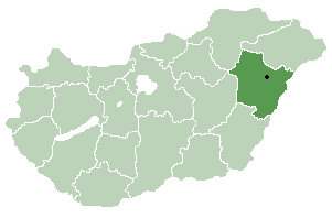
Nyírmártonfalva is a village in Hajdú-Bihar county, in the Northern Great Plain region of eastern Hungary.
People
Economy
C+Climate
| Population | 2,130 |
| Population Density | 96 / sq mi |
| Elevation | 472 ft (144 m) |
| Coordinates | 47.5833°, 21.9000° |
| Timezone | Europe/Budapest |
| Country | 🇭🇺 Hungary |
| State / Province | Hajdú-Bihar |
| Average Temperature | 49°F (10°C) |
| January Average | 29°F (-2°C) |
| July Average | 68°F (20°C) |
| Annual Precipitation | 21.9 inches (555 mm) |
| Annual Snowfall | 4.1 inches (10 cm) |
| Median Household Income | $15,228 |
About Nyírmártonfalva
Nyírmártonfalva is a small town in Hungary (Hajdú-Bihar) with a population of 2,130. The city sits at an elevation of 472 feet (144 meters) above sea level. The average annual temperature is 49°F (10°C). Temperatures range from 29°F in January to 68°F in July. Annual precipitation averages 21.9 inches. The timezone is Europe/Budapest.
Income: Nyírmártonfalva vs Hungary
Commute Mode
Income
| Median HH Income | $15,228 |
| 80% below Hungary avg |
Employment & Poverty
| Establishments (County) | 100 |
Business (County)
Tax & Cost of Living
Commute & Transportation
Walkability
Climate in Nyírmártonfalva
Nyírmártonfalva has an average annual temperature of 11.1°C (52°F). The hottest month is Jul (21.9°C), the coldest is Jan (-0.7°C). Average annual precipitation is 549 mm.
Temperature
| Annual Average | 49.4°F |
| 9% below Hungary avg | |
| January Average | 29°F (-2°C) |
| July Average | 68°F (20°C) |
| Sunny Days | 296 days/yr |
Geography
| Elevation | 472 ft (144 m) |
| Area | 22.2 sq mi (57.5 km²) |
| Population Density | 96/sq mi |
| Coordinates | 47.5833°N, 21.9000°W |
| Timezone | Europe/Budapest |
Precipitation & Snow
Air Quality
Monthly Weather
| Month | Avg Temperature | Precipitation | Summary |
|---|---|---|---|
| January | 29°F (-2°C) | 1.3 in | Coldest |
| February | 32°F (0°C) | 1.1 in | Driest |
| March | 41°F (5°C) | 1.3 in | |
| April | 51°F (10°C) | 1.9 in | |
| May | 60°F (16°C) | 2.4 in | |
| June | 65°F (18°C) | 2.9 in | Wettest |
| July | 68°F (20°C) | 2.5 in | Warmest |
| August | 67°F (20°C) | 2.1 in | |
| September | 60°F (15°C) | 1.7 in | |
| October | 50°F (10°C) | 1.3 in | |
| November | 39°F (4°C) | 1.7 in | |
| December | 32°F (-0°C) | 1.7 in |
Nyírmártonfalva has a seasonal temperature swing of 39°F / from 29°F in January to 68°F in July. Total annual precipitation is 21.8 inches, with June being the wettest month (2.9") and February the driest (1.1").
Radio Stations near Nyírmártonfalva
2 stations within ~55 km.
| Station | Genre | Quality | |
|---|---|---|---|
| Hobby Rádió | 70s, 80s | MP3 128 kbps | |
| Folkrádió | — | MP3 128 kbps |
Museums in Nyírmártonfalva
| Name | Type | Address | Phone | Annual Revenue |
|---|---|---|---|---|
| "Andrássy Ernő" History and Ethnography Museum | ||||
| "Kazinczy Ferenc, Fr?ter L?r?nd and Csiha K?lm?n" Memorial Museum | ||||
| Bődi István Falumúzeum és Tájház | ||||
| Élő Tájház | ||||
| Erdőspusztai Bemutatóház | ||||
| Erdőspusztai Bemutatóház | ||||
| History, Archaeology and Ethnography Museum Collection of the Ierului Valley | ||||
| Hosszúpályi Bormúzeum | ||||
| Irinyi János Kiállítóterem | ||||
| Kölcsey-kúria | ||||
| Kovácsmúzeum | ||||
| Magtár Múzeum | ||||
| Népművészeti bemutatóház | ||||
| Népművészeti bemutatóház | ||||
| Nyírmártonfalva Falumúzeum | ||||
| Szőlőskerti Tájház | ||||
| Tájház | ||||
| Tájház | ||||
| Tájház | ||||
| Tájház | ||||
| Újfehértói Múzeum | ||||
| Vízi vágóhíd |
Libraries in Nyírmártonfalva
| Name | Address | Staff | Annual Visits | Circulation | Collection | Programs |
|---|---|---|---|---|---|---|
| Biblioteca Orășenească ”Máté Imre” | 0.0 | |||||
| Biblioteca Școlară | 0.0 | |||||
| Földi János Könyvtár, Emlékház, Galéria | 0.0 | |||||
| József Attila telepi Könyvtár | 0.0 | |||||
| Könyvtár | 0.0 | |||||
| Községi könyvtár | 0.0 | |||||
| Ligetalja Könyvtár | 0.0 | |||||
| Méliusz Zsuzsi Erdei Vasút ZSEV KönyvtárPont | 0.0 | |||||
| Monostorpályi Gondozási Központ és Községi Könyvtár | 0.0 | |||||
| Petőfi Sándor Városi Könyvtár | 0.0 | |||||
| Városi Könyvtár | 0.0 |
Farmers Markets in Nyírmártonfalva
| Name | Address | Season | Hours | Organic | Website |
|---|---|---|---|---|---|
| Bagosi Piac | |||||
| Használt cikk és iparcikk piac (Zsibi) | |||||
| Hosszúpályi Piactér | |||||
| Ócska piac | |||||
| Piac és vásártér | |||||
| Piață(Piac) | |||||
| Régi piactér | |||||
| Városi Piac | |||||
| Városi piac | |||||
| Városi Piac | |||||
| Városi piac | |||||
| Vásárcsarnok |
Theatres in Nyírmártonfalva
1 theatres within city radius — OpenStreetMap data
Castles in Nyírmártonfalva
2 castles within city radius — OpenStreetMap data
Stadiums & Teams in Nyírmártonfalva
| Team | League | Division |
|---|---|---|
Airports Near Nyírmártonfalva
10 airports within the area.
| Airport | IATA | Type |
|---|---|---|
| Debrecen International Airport | DEB | Large Airport |
| Oradea International Airport | OMR | Large Airport |
| Balkány Airfield | — | Small Airport |
| Biharkeresztes Airfield | — | Small Airport |
| Hajdúszoboszló Airfield | — | Small Airport |
| Ineu King's Land Airfield | — | Small Airport |
| Kosino Spa Resort Airfield | — | Small Airport |
| Laci Oros Airfield | — | Small Airport |
| Nyíregyháza Airfield | — | Small Airport |
| Sárospatak Airfield | — | Small Airport |
Treatment Centers in Nyírmártonfalva
1 treatment centers.
| Center | Type | Phone |
|---|---|---|
| Borostyán Med Hotel |
Churches & Religious Organizations in Nyírmártonfalva
3 religious organizations (IRS tax-exempt data).
| Name | Address |
|---|---|
| Buzitai iskolakápolna | |
| Református templom | |
| Szent Miklós püspök templom |
Quick Facts
🇭🇺 About Hungary
Public Holidays in Hungary
13 public holidays this year
Download Full City Report
Get a comprehensive, print-ready PDF with all data for Nyírmártonfalva.
Get ReportFrequently Asked Questions About Nyírmártonfalva
What is the population of Nyírmártonfalva?
Nyírmártonfalva has a population of 2,130 residents and is located in Hungary. The population density is 96 people per square mile, spread across 22.2 square miles.
Is Nyírmártonfalva expensive to live in?
The median household income is $15,228, 80% below the national average of $75,149.
What is the weather like in Nyírmártonfalva?
Nyírmártonfalva has a four-season climate with an average annual temperature of 49°F (10°C). Winter temperatures average 29°F in January, while summers reach an average of 68°F in July. The area receives 296 sunny days per year, well above the national average of 205. Annual rainfall totals 21.9 inches, with 4.1 inches of snow.
How is the job market in Nyírmártonfalva?
There are 100 business establishments in the area.