 All Countries


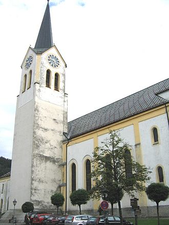
Oberstaufen, Germany
Bavaria · Germany
Oberstaufen is a small city in Bavaria, Germany with a population of 7,190. Elevation: 2,592 ft (790 m). Average temperature: 44°F (7°C).
Discover Oberstaufen, Germany
Explore over 40 sections covering people, economy, housing, health, crime, climate, community, costs, trends, schools, colleges, hospitals, treatment centers, industries, museums, libraries, breweries, farmers markets, grocery stores, pharmacies, campgrounds, parks, trails, stadiums, ski resorts, daycare centers, nursing homes, churches, fire stations, cell towers, bridges, power plants, EV stations, prisons, radio stations, airports, police stations, post offices, Amtrak stations, superfund sites, UNESCO sites, and more.
Use the tabs and dropdown menus below to navigate every data point we track for this city.
About Oberstaufen
Oberstaufen is a municipality in the district of Oberallgäu in Bavarian Swabia, Germany, situated on the B 308 road from Lindau to Immenstadt.
People
Economy
C+Housing
A+Climate
| Population | 7,190 |
| Population Density | 141 / sq mi |
| Elevation | 2,592 ft (790 m) |
| Coordinates | 47.5557°, 10.0225° |
| Timezone | Europe/Berlin |
| Country | 🇩🇪 Germany |
| State / Province | Bavaria |
| Average Temperature | 44°F (7°C) |
| January Average | 28°F (-2°C) |
| July Average | 59°F (15°C) |
| Annual Precipitation | 104.4 inches (2,653 mm) |
| Annual Snowfall | 237.8 inches (604 cm) |
| Median Household Income | $33,724 |
About Oberstaufen
Oberstaufen is a small city in Germany (Bavaria) with a population of 7,190. The city sits at an elevation of 2,592 feet (790 meters) above sea level. The average annual temperature is 44°F (7°C). Temperatures range from 28°F in January to 59°F in July. Annual precipitation averages 104.4 inches. The timezone is Europe/Berlin.
Income: Oberstaufen vs Germany
Commute Mode
Income
| Median HH Income | $33,724 |
| 55% below Germany avg |
Employment & Poverty
| Establishments (County) | 280 |
Business (County)
Tax & Cost of Living
Commute & Transportation
Walkability
Home Value Sources
Ownership Split
Home Values
| Census Median | $120,400 |
| 57% below Germany avg |
Real Estate Market (Redfin)
Rental Costs
| Census Median Rent | $602 |
| 48% below Germany avg |
Ownership & Property
| Homeownership | 48.9% |
| Owner-Occupied | 48.9% |
| Renter-Occupied | 51.1% |
| Housing Units | 2,876 |
Property Tax
Climate in Oberstaufen
Oberstaufen has an average annual temperature of 7.4°C (45°F). The hottest month is Jul (16.6°C), the coldest is Jan (-2.2°C). Average annual precipitation is 1687 mm.
Temperature
| Annual Average | 44.0°F |
| 19% below Germany avg | |
| January Average | 28°F (-2°C) |
| July Average | 59°F (15°C) |
| Sunny Days | 239 days/yr |
Geography
| Elevation | 2,592 ft (790 m) |
| Area | 51.1 sq mi (132.4 km²) |
| Population Density | 141/sq mi |
| Coordinates | 47.5557°N, 10.0225°W |
| Timezone | Europe/Berlin |
Precipitation & Snow
Air Quality
Tsunami History
2 tsunamis recorded within 500 km. Highest wave on record: 95.0 m (312 ft).
| Year | Location | Cause | Max Wave | Deaths | Distance |
| 1987 | VALTELLINA | Meteorological | 95.0 m | 27 | 133 km |
| 1601 | LAKE LUCERNE | Eruption + Earthquake | 4.0 m | 8 | 143 km |
Monthly Weather
| Month | Avg Temperature | Precipitation | Summary |
|---|---|---|---|
| January | 28°F (-2°C) | 4.2 in | Coldest, Driest |
| February | 30°F (-1°C) | 4.3 in | |
| March | 36°F (2°C) | 4.4 in | |
| April | 41°F (5°C) | 4.8 in | |
| May | 50°F (10°C) | 5.4 in | |
| June | 55°F (13°C) | 7.4 in | |
| July | 59°F (15°C) | 7.4 in | Wettest |
| August | 60°F (15°C) | 6.7 in | Warmest |
| September | 54°F (12°C) | 5.2 in | |
| October | 46°F (8°C) | 4.3 in | |
| November | 36°F (2°C) | 5.2 in | |
| December | 31°F (-1°C) | 4.8 in |
Oberstaufen has a seasonal temperature swing of 31°F / from 28°F in January to 60°F in August. Total annual precipitation is 64.2 inches, with July being the wettest month (7.4") and January the driest (4.2").
Schools in Oberstaufen
2 public schools (NCES 2022-23 data).
| School | Level | Enrollment | Teachers | Student/Teacher |
|---|---|---|---|---|
| Grund- und Mittelschule Oberstaufen | — | — | — | — |
| Kinderheim St. Maria | — | — | — | — |
Radio Stations near Oberstaufen
16 stations within ~55 km.
| Station | Genre | Quality | |
|---|---|---|---|
| Radio Vorarlberg HQ (AT) | orf | MP3 192 kbps | |
| Antenne Vorarlberg Partymix (AT) | club, dance | AAC | |
| Radio Vorarlberg (AT) | orf | MP3 128 kbps | |
| Antenne Vorarlberg Oldies but Goldies (AT) | classic, classic hits | AAC | |
| Antenne Vorarlberg (AT) | — | AAC | |
| Radio Horeb (127 kbps) | catholic, christian | MP3 128 kbps | |
| Radio Horeb (32 kbps) | catholic, christian | AAC+ 64 kbps | |
| Antenne Vorarlberg Classic Rock (AT) | classic, rock | MP3 128 kbps | |
| Hitradio RT1 Südschwaben | charts, pop | AAC | |
| Radio free FM | alternative, community radio | MP3 192 kbps | |
| Antenne Vorarlberg Musica Italiana (AT) | italian | AAC | |
| Antenne Vorarlberg 2000er Hits (AT) | 2000er, 2000s | AAC | |
| Proton - das freie Radio (AT) | — | MP3 192 kbps | |
| AllgäuHIT | — | MP3 192 kbps | |
| Antenne Vorarlberg Schlagerkult (AT) | schlager | AAC | |
| Maretimo Chill Radio | chill out | MP3 128 kbps |
Museums in Oberstaufen
| Name | Type | Address | Phone | Annual Revenue |
|---|---|---|---|---|
| Allgäuer Bergbauernmuseum | ||||
| Allgäuer Bergbauernmuseum e.V. | ||||
| Angelika Kauffmann Museum | ||||
| Badstube | ||||
| Barockbaumeister-Museum | ||||
| Deutsches Hutmuseum | ||||
| Dorfmuseum Leupolz | ||||
| Egg Museum | ||||
| Felder Museum | ||||
| Glashütte Schmidsfelden im Allgäu | ||||
| Gschwenderhaus | ||||
| Handwerkermuseum | ||||
| Heimathaus Gestratz | ||||
| Heimatmuseum | ||||
| Heimatmuseum | ||||
| Heimatmuseum | ||||
| Heimatmuseum "Beim Strumpfar" | ||||
| Heimatmuseum Alberschwende | ||||
| Heimatmuseum Bezau | ||||
| Heimatmuseum Hergensweiler | ||||
| Heimatmuseum Hofmühle | ||||
| Heimatstube | ||||
| Hittisau Women's Museum | ||||
| Kornhaus | ||||
| Krippenmuseum Dornbirn | ||||
| MBZ-Modell Bahn Zentrum - Stellwerk "Süd" | ||||
| Museum ERBA | ||||
| Musikmuseum Eglofs | ||||
| Naturparkzentrum Nagelfluhkette | ||||
| Obermühle | ||||
| Rolls-Royce-Museum | ||||
| s'Huimatle | ||||
| Städtische Museen Wangen im Allgäu | ||||
| Walser Museum | ||||
| Wassertormuseum | ||||
| Westallgäuer Heimatmuseum |
Libraries in Oberstaufen
| Name | Address | Staff | Annual Visits | Circulation | Collection | Programs |
|---|---|---|---|---|---|---|
| Andelsbücherei | 0.0 | |||||
| Bücherei | 0.0 | |||||
| Bücherei Altusried | 0.0 | |||||
| Bücherei Egg | 0.0 | |||||
| Bücherei im Walserhaus | 0.0 | |||||
| Bücherei Krumbach | 0.0 | |||||
| Bücherei Langenegg | 0.0 | |||||
| Bücherei Mediathek & Weltladen | 0.0 | |||||
| Bücherei Wiggensbach | 0.0 | |||||
| Gemeindebücherei | 0.0 | |||||
| Gemeindebücherei | 0.0 | |||||
| Gemeindebücherei Buchenberg | 0.0 | |||||
| Katholisches Pfarrhaus | 0.0 | |||||
| Lindohus | 0.0 | |||||
| Literaturhaus Allgäu | 0.0 | |||||
| St. Benedikt Eisenharz | 0.0 | |||||
| Stadtbücherei | 0.0 | |||||
| Stadtbücherei | 0.0 | |||||
| Stadtbücherei im Kornhaus | 0.0 | |||||
| Stadtbücherei Isny | 0.0 |
Farmers Markets in Oberstaufen
| Name | Address | Season | Hours | Organic | Website |
|---|---|---|---|---|---|
| Deuchelrieder Dorfmarkt | |||||
| Viehmarkt / Flohmarkt | |||||
| Wochenmarkt | |||||
| Wochenmarkt | |||||
| Wochenmarkt | |||||
| Wochenmarkt | |||||
| Wochenmarkt Wiggensbach | |||||
| Ziegen-, Noriker- und Schafausstellung |
Hotels in Oberstaufen
46 hotels within city radius — OpenStreetMap data
Restaurants in Oberstaufen
51 restaurants within city radius — OpenStreetMap data
Cafes in Oberstaufen
9 cafes within city radius — OpenStreetMap data
Zoos in Oberstaufen
1 zoos within city radius — OpenStreetMap data
Dentists in Oberstaufen
1 dentists within city radius — OpenStreetMap data
Train Stations in Oberstaufen
1 train stations within city radius — OpenStreetMap data
Bus Stations in Oberstaufen
1 bus stations within city radius — OpenStreetMap data
Gas Stations in Oberstaufen
2 gas stations within city radius — OpenStreetMap data
Banks in Oberstaufen
1 banks within city radius — OpenStreetMap data
Gyms in Oberstaufen
1 gyms within city radius — OpenStreetMap data
Golf Courses in Oberstaufen
1 golf courses within city radius — OpenStreetMap data
Breweries in Oberstaufen
| Name | Type | Address | Phone | Website |
|---|---|---|---|---|
| Brauerei Egg | ||||
| Edelweissbrauerei Farny | ||||
| Meckatzer Löwenbräu | ||||
| Schäffler Bräu |
Stadiums & Teams in Oberstaufen
| Team | League | Division |
|---|---|---|
Ski Resorts Near Oberstaufen
95 ski resorts within range.
| Resort | Slopes (km) | Lifts | Peak (m) | Price | Season | Night | Park |
|---|---|---|---|---|---|---|---|
| Nordic Zentrum Oberstdorf | 0.0 | — | — | $0 | — | — | — |
| Hörnerbahn Bolsterlang | 0.0 | — | — | $0 | — | — | — |
| Balderschwang – Hochschelpen/Riedberger Horn | 0.0 | — | — | $0 | — | — | — |
| Grub-Kaien | 0.0 | — | — | $0 | — | — | — |
| Bischofsberg | 0.0 | — | — | $0 | — | — | — |
| Oberegg-St. Anton | 0.0 | — | — | $0 | — | — | — |
| Schetteregg | 0.0 | — | — | $0 | — | — | — |
| Nebelhorn | 0.0 | — | — | $0 | — | — | — |
| Bödele | 0.0 | — | — | $0 | — | — | — |
| Orlen Arena Oberstdorf Allgäu | 0.0 | — | — | $0 | — | — | — |
| Niedere Andelsbuch-Bezau | 0.0 | — | — | $0 | — | — | — |
| Söllereck | 0.0 | — | — | $0 | — | — | — |
| Schollenwiesenlift Höfen | 0.0 | — | — | $0 | — | — | — |
| Familienskipark Stanzach | 0.0 | — | — | $0 | — | — | — |
| Heini-Klopfer-Skiflugschanze | 0.0 | — | — | $0 | — | — | — |
| Kleinwalsertal-Oberstdorf | 0.0 | — | — | $0 | — | — | — |
| Ifen | 0.0 | — | — | $0 | — | — | — |
| Fellhorn/Kanzelwand | 0.0 | — | — | $0 | — | — | — |
| Heumöserlift | 0.0 | — | — | $0 | — | — | — |
| Heuberg Arena/Walmendingerhorn | 0.0 | — | — | $0 | — | — | — |
| Ski lift Schwärzenbach | 0.0 | — | — | $0 | — | — | — |
| Tallifte | 0.0 | — | — | $0 | — | — | — |
| Diedamskopf | 0.0 | — | — | $0 | — | — | — |
| Sollegg | 0.0 | — | — | $0 | — | — | — |
| Immenstadt | 0.0 | — | — | $0 | — | — | — |
| Gohrersberg – Kreuzthal | 0.0 | — | — | $0 | — | — | — |
| Isny / Felderhalde | 0.0 | — | — | $0 | — | — | — |
| Wengen | 0.0 | — | — | $0 | — | — | — |
| Sulzberg | 0.0 | — | — | $0 | — | — | — |
| Iberg | 0.0 | — | — | $0 | — | — | — |
| Ellegglifte – Faistenoy | 0.0 | — | — | $0 | — | — | — |
| Nesselwang - Alpspitzbahnen | 0.0 | — | — | $0 | — | — | — |
| Buron | 0.0 | — | — | $0 | — | — | — |
| Sonnenlifte Röfleuten/Halden | 0.0 | — | — | $0 | — | — | — |
| Skilifte Thaler Höhe | 0.0 | — | — | $0 | — | — | — |
| Skizentrum Pfronten | 0.0 | — | — | $0 | — | — | — |
| Gonten | 0.0 | — | — | $0 | — | — | — |
| Hinterstaufen | 0.0 | — | — | $0 | — | — | — |
| Spieserlifte | 0.0 | — | — | $0 | — | — | — |
| Hagenberg Sulzberg-Thal | 0.0 | — | — | $0 | — | — | — |
| Hindelang Oberjoch | 0.0 | — | — | $0 | — | — | — |
| Füssener Jöchle-Grän | 0.0 | — | — | $0 | — | — | — |
| Hochlitten-Riefensberg | 0.0 | — | — | $0 | — | — | — |
| Ofterschwang/Gunzesried | 0.0 | — | — | $0 | — | — | — |
| Pfänder | 0.0 | — | — | $0 | — | — | — |
| Tannheim-Zöblen-Schattwald | 0.0 | — | — | $0 | — | — | — |
| Hochhäderich | 0.0 | — | — | $0 | — | — | — |
| Hahnenkamm Höfen | 0.0 | — | — | $0 | — | — | — |
| Junker - St. Antönien | 0.0 | — | — | $0 | — | — | — |
| Golm | 0.0 | — | — | $0 | — | — | — |
| Kappl | 0.0 | — | — | $0 | — | — | — |
| See | 0.0 | — | — | $0 | — | — | — |
| Serfaus-Fiss-Ladis | 0.0 | — | — | $0 | — | — | — |
| Fendels | 0.0 | — | — | $0 | — | — | — |
| Silvretta Montafon | 0.0 | — | — | $0 | — | — | — |
| Pizol Bad Ragaz | 0.0 | — | — | $0 | — | — | — |
| Flensa-Seewis | 0.0 | — | — | $0 | — | — | — |
| Mathon | 0.0 | — | — | $0 | — | — | — |
| Übungsgelände Valisera | 0.0 | — | — | $0 | — | — | — |
| Skilift Tristeli St. Margrethenberg | 0.0 | — | — | $0 | — | — | — |
| Malbun | 0.0 | — | — | $0 | — | — | — |
| Ischgl-Samnaun | 0.0 | — | — | $0 | — | — | — |
| Skilift Mastrils | 0.0 | — | — | $0 | — | — | — |
| Galtür | 0.0 | — | — | $0 | — | — | — |
| Gargellen | 0.0 | — | — | $0 | — | — | — |
| Grüsch Danusa | 0.0 | — | — | $0 | — | — | — |
| Pany | 0.0 | — | — | $0 | — | — | — |
| Silvretta-Bielerhöhe | 0.0 | — | — | $0 | — | — | — |
| Madrisa | 0.0 | — | — | $0 | — | — | — |
| Nauders am Reschenpass | 0.0 | — | — | $0 | — | — | — |
| Kaunertaler Gletscher | 0.0 | — | — | $0 | — | — | — |
| Fideriser Heuberge | 0.0 | — | — | $0 | — | — | — |
| Frastanz-Gurtis | 0.0 | — | — | $0 | — | — | — |
| Brülisau Leugangen | 0.0 | — | — | $0 | — | — | — |
| Ebenalp-Horn | 0.0 | — | — | $0 | — | — | — |
| Knittellifte | 0.0 | — | — | $0 | — | — | — |
| Furx | 0.0 | — | — | $0 | — | — | — |
| Zwergberg Furx | 0.0 | — | — | $0 | — | — | — |
| Jöchelspitze | 0.0 | — | — | $0 | — | — | — |
| Laterns-Gapfohl | 0.0 | — | — | $0 | — | — | — |
| Gföllberglift | 0.0 | — | — | $0 | — | — | — |
| Gröllerkopf-Übersaxen | 0.0 | — | — | $0 | — | — | — |
| Sonntag Stein | 0.0 | — | — | $0 | — | — | — |
| Raggal | 0.0 | — | — | $0 | — | — | — |
| Skilift Selfranga | 0.0 | — | — | $0 | — | — | — |
| Ski Arlberg | 0.0 | — | — | $0 | — | — | — |
| Wildhaus | 0.0 | — | — | $0 | — | — | — |
| Tschardund – Nenzing | 0.0 | — | — | $0 | — | — | — |
| Flirsch | 0.0 | — | — | $0 | — | — | — |
| Venet | 0.0 | — | — | $0 | — | — | — |
| Skilift Malbun | 0.0 | — | — | $0 | — | — | — |
| Rotecklift / Tobadill | 0.0 | — | — | $0 | — | — | — |
| Brandnertal – Brand/Bürserberg | 0.0 | — | — | $0 | — | — | — |
| Sonnenkopf | 0.0 | — | — | $0 | — | — | — |
| Kristberg-Silbertal | 0.0 | — | — | $0 | — | — | — |
Airports Near Oberstaufen
33 airports within the area.
| Airport | IATA | Type |
|---|---|---|
| Bodensee Airport Friedrichshafen | FDH | Large Airport |
| Memmingen Allgau Airport | FMM | Large Airport |
| Laupheim Air Base | — | Medium Airport |
| Mengen-Hohentengen Airfield | — | Medium Airport |
| Sankt Gallen Altenrhein Airport | ACH | Medium Airport |
| Agathazell Airfield | — | Small Airport |
| Bad Ragaz Airfield | — | Small Airport |
| Bad Saulgau Airfield | — | Small Airport |
| Bad Wörishofen (Nord) Airfield | — | Small Airport |
| Bad Wörishofen Glider Airfield | — | Small Airport |
| Berg Airfield | — | Small Airport |
| Biberach an der Riß Airfield | — | Small Airport |
| Füssen Glider Airfield | — | Small Airport |
| Hayingen Glider Field | — | Small Airport |
| Heiligenberg Glider Field | — | Small Airport |
| Hohenems-Dornbirn Airfield | HOH | Small Airport |
| Illertissen Airfield | — | Small Airport |
| Isny Glider Field | — | Small Airport |
| Kaufbeuren Air Base | — | Small Airport |
| Kempten-Durach Airfield | — | Small Airport |
| Leutkirch-Unterzeil Airfield | — | Small Airport |
| Markdorf Glider Field | — | Small Airport |
| Mindelheim-Mattsies Airfield | — | Small Airport |
| Reute/Bad Waldsee Airfield | — | Small Airport |
| Reutte-Höfen Airfield | — | Small Airport |
| Riedlingen Airfield | — | Small Airport |
| Schlechtenfeld Glider Strip | — | Small Airport |
| Schwabmünchen Airfield | — | Small Airport |
| Tannheim Airfield | — | Small Airport |
| Thannhausen Airfield | — | Small Airport |
| Wangen-Kißlegg Airfield | — | Small Airport |
| Weißenhorn Airfield | — | Small Airport |
| Wildberg Airfield | — | Small Airport |
Treatment Centers in Oberstaufen
6 treatment centers.
| Center | Type | Phone |
|---|---|---|
| Evangelische Mutter-Kind-Kurklinik Scheidegg | ||
| Fachklinik Prinzregent Luitpold | ||
| Fachklinik Schönau | ||
| Klinik Maximilian | ||
| Kurklinik Allgäuer Bergbad | ||
| Vitrea-Klinik |
Churches & Religious Organizations in Oberstaufen
27 religious organizations (IRS tax-exempt data).
| Name | Address |
|---|---|
| Bruder-Klaus-Kapelle | |
| Heilig-Geist-Kirche | |
| Hl. Maria | |
| Jesuskapelle | |
| Josef Kapelle | |
| Kalvarienbergkapelle | |
| Kalvarienbergkapelle | |
| Kapelle Hochwies | |
| Kapelle Steinebach | |
| Lourdes-Grotte | |
| Marienkapelle | |
| Neuapostolische Kirche Oberstaufen | |
| Ölbergkapelle | |
| Sankt Martin | |
| Siechenkapelle | |
| Spinner Kapelle | |
| St. Anna | |
| St. Bartholomäus | |
| St. Georg | |
| St. Johannes Baptist |
Explore Near Oberstaufen
Quick Facts
🇩🇪 About Germany
Public Holidays in Germany
19 public holidays this year
Download Full City Report
Get a comprehensive, print-ready PDF with all data for Oberstaufen.
Get ReportFrequently Asked Questions About Oberstaufen
What is the population of Oberstaufen?
Oberstaufen has a population of 7,190 residents and is located in Germany. The population density is 141 people per square mile, spread across 51.1 square miles.
Is Oberstaufen expensive to live in?
The median household income is $33,724, 55% below the national average of $75,149. The median home value is $120,400 (57% below the U.S. median). Renters pay a median of $602 per month, below the national average of $1,163. The home price-to-income ratio is 3.6x, indicating housing is reasonably affordable relative to local income levels.
What is the weather like in Oberstaufen?
Oberstaufen has a cool climate with an average annual temperature of 44°F (7°C). Winter temperatures average 28°F in January, while summers reach an average of 59°F in July. The area receives 239 sunny days per year. Annual rainfall totals 104.4 inches, with 237.8 inches of snow.
How is the job market in Oberstaufen?
There are 280 business establishments in the area.
How much does housing cost in Oberstaufen?
The median home value in Oberstaufen is $120,400. For renters, the median monthly rent is $602. The homeownership rate is 48.9%.