Payán, Colombia
Nariño · Colombia
Payán is a small town in Nariño, Colombia with a population of 2,892. Elevation: 118 ft (36 m). Average temperature: 79°F (26°C).
Population source: Wikidata (dated census and official estimates), GeoNames. Climate: WorldClim 2.1 normals (1970-2000), NASA POWER. Updated August 2026
Discover Payán, Colombia
Explore over 40 sections covering people, economy, housing, health, crime, climate, community, costs, trends, schools, colleges, hospitals, treatment centers, industries, museums, libraries, breweries, farmers markets, grocery stores, pharmacies, campgrounds, parks, trails, stadiums, ski resorts, daycare centers, nursing homes, churches, fire stations, cell towers, bridges, power plants, EV stations, prisons, radio stations, airports, police stations, post offices, Amtrak stations, superfund sites, UNESCO sites, and more.
Use the tabs and dropdown menus below to navigate every data point we track for this city.
About Payán
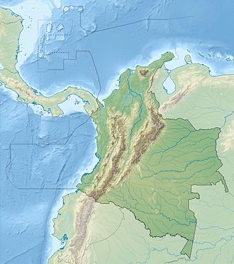
Payán är en ort i Colombia. Den ligger i departementet Nariño, i den västra delen av landet, 500 km sydväst om huvudstaden Bogotá. Payán ligger 45 meter över havet och antalet invånare är 2 892.
People
Climate
| Population | 2,892 |
| Population Density | 3 / sq mi |
| Elevation | 118 ft (36 m) |
| Coordinates | 1.7665°, -78.1833° |
| Timezone | America/Bogota |
| Country | 🇨🇴 Colombia |
| State / Province | Nariño |
| Average Temperature | 79°F (26°C) |
| January Average | 78°F (26°C) |
| July Average | 78°F (26°C) |
| Annual Precipitation | 187.2 inches (4,755 mm) |
| Annual Snowfall | 0.0 inches (0 cm) |
About Payán
Payán is a small town in Colombia (Nariño) with a population of 2,892. The city sits at an elevation of 118 feet (36 meters) above sea level. The average annual temperature is 79°F (26°C). Temperatures range from 78°F in January to 78°F in July. Annual precipitation averages 187.2 inches. The timezone is America/Bogota.
Temperature
| Annual Average | 78.5°F |
| 45% above Colombia avg | |
| January Average | 78°F (26°C) |
| July Average | 78°F (26°C) |
Geography
| Elevation | 118 ft (36 m) |
| Area | 897.3 sq mi (2,324.0 km²) |
| Population Density | 3/sq mi |
| Coordinates | 1.7665°N, 78.1833°W |
| Timezone | America/Bogota |
Precipitation & Snow
Air Quality
Tsunami History
2 tsunamis recorded within 500 km. Highest wave on record: 6.0 m (20 ft).
| Year | Location | Cause | Max Wave | Deaths | Distance |
| 1979 | COLOMBIA: OFF SHORE, PACIFIC OCEAN | Earthquake | 6.0 m | 600 | 124 km |
| 1958 | COLOMBIA-ECUADOR | Earthquake | - | 115 | 149 km |
Nearby Volcanoes
9 volcanoes within 200 km. Closest: Cumbal (97 km).
| Name | Type | Elevation | Last Eruption | Distance |
| Cumbal | Stratovolcano | 4,764 m (15,630 ft) | 1926 | 97 km |
| Galeras | Complex | 4,276 m (14,029 ft) | 2014 | 109 km |
| Chiles-Cerro Negro | Stratovolcano | 4,698 m (15,413 ft) | 1936 | 109 km |
| Chachimbiro | Stratovolcano | 4,106 m (13,471 ft) | -3740 | 145 km |
| Cuicocha | Caldera | 3,246 m (10,650 ft) | 650 | 163 km |
| Imbabura | Compound | 4,609 m (15,121 ft) | -5550 | 168 km |
| Mojanda | Stratovolcano(es) | 4,263 m (13,986 ft) | Unknown | 182 km |
| Cayambe | Compound | 5,790 m (18,996 ft) | 1786 | 194 km |
| Pululahua | Caldera | 3,356 m (11,010 ft) | 290 | 195 km |
Monthly Weather
| Month | Avg Temperature | Precipitation | Summary |
|---|---|---|---|
| January | 78°F (26°C) | 16.7 in | |
| February | 79°F (26°C) | 15.5 in | |
| March | 79°F (26°C) | 15.1 in | Warmest |
| April | 79°F (26°C) | 19.1 in | |
| May | 79°F (26°C) | 24.3 in | Wettest |
| June | 78°F (26°C) | 19.3 in | |
| July | 78°F (26°C) | 13.7 in | |
| August | 78°F (26°C) | 12.0 in | Coldest |
| September | 78°F (26°C) | 14.4 in | |
| October | 78°F (26°C) | 13.5 in | |
| November | 78°F (26°C) | 11.4 in | Driest |
| December | 78°F (26°C) | 12.4 in |
Payán has a seasonal temperature swing of 1°F / from 78°F in August to 79°F in March. Total annual precipitation is 187.2 inches, with May being the wettest month (24.3") and November the driest (11.4").
Schools in Payán
8 public schools (OpenStreetMap data).
| School | Level | Enrollment | Teachers | Student/Teacher |
|---|---|---|---|---|
| Escuela Rural Mixta Pueblo Nuevo | - | - | - | - |
| Escuela Rural Mixta El Piaunde | - | - | - | - |
| Escuela Rural Mixta Brisas de Hamburgo | - | - | - | - |
| Escuela Rural Mixta de Estero Seco Arriba | - | - | - | - |
| Escuela Rural Mix Estero Seco Abajo | - | - | - | - |
| Escuela Nuestra Señora del Carmen | - | - | - | - |
| Escuela Rural Mixta La Aurora | - | - | - | - |
| Institucion Educativa Eliseo Payan (IEEP) - Sede Ciudadela | - | - | - | - |
Airports Near Payán
8 airports within the area.
| Airport | IATA | Type |
|---|---|---|
| La Florida Airport | TCO | Medium Airport |
| Bocas De Satinga Airport | - | Small Airport |
| El Charco Airport | ECR | Small Airport |
| Maguí Payán Airport | - | Small Airport |
| Palpailón | - | Small Airport |
| Payán Airport | PYN | Small Airport |
| San Lorenzo Airport | - | Small Airport |
| Santa Bárbara Airport | ISD | Small Airport |
Churches & Religious Organizations in Payán
1 religious organizations (IRS tax-exempt data).
| Name | Address |
|---|---|
| Iglesia Católica |
Quick Facts
🇨🇴 About Colombia
Public Holidays in Colombia
18 public holidays this year
Frequently Asked Questions About Payán
What is the population of Payán?
Payán has a population of 2,892 residents and is located in Colombia. The population density is 3 people per square mile, spread across 897.3 square miles.
What is the weather like in Payán?
Payán has a warm climate with an average annual temperature of 79°F (26°C). Winter temperatures average 78°F in January, while summers reach an average of 78°F in July. Annual rainfall totals 187.2 inches.
Nearby Cities
Want every data point for Payán?
The full profile puts all sections on one printable page, no tabs.
Full City Profile