 All Countries


Portscatho, United Kingdom
England · United Kingdom
Portscatho is a small town in England, United Kingdom with a population of 1,500. Elevation: 26 ft (8 m). Average temperature: 51°F (11°C).
Discover Portscatho, United Kingdom
Explore over 40 sections covering people, economy, housing, health, crime, climate, community, costs, trends, schools, colleges, hospitals, treatment centers, industries, museums, libraries, breweries, farmers markets, grocery stores, pharmacies, campgrounds, parks, trails, stadiums, ski resorts, daycare centers, nursing homes, churches, fire stations, cell towers, bridges, power plants, EV stations, prisons, radio stations, airports, police stations, post offices, Amtrak stations, superfund sites, UNESCO sites, and more.
Use the tabs and dropdown menus below to navigate every data point we track for this city.
About Portscatho
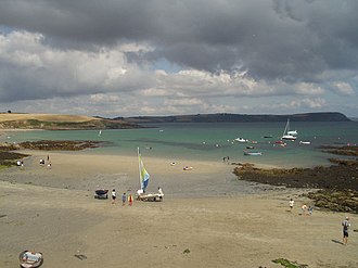
Portscatho is a coastal village on the Roseland Peninsula in Cornwall, England, United Kingdom. The village adjoins Gerrans on the east side of the peninsula, about seven miles (11 km) south-southeast of Truro. It has an estimated population of 1,500 people.
People
Economy
BHousing
A+Climate
Education
A+Community
| Population | 1,500 |
| Population Density | 498 / sq mi |
| Elevation | 26 ft (8 m) |
| Coordinates | 50.1727°, -4.9736° |
| Timezone | Europe/London |
| Country | 🇬🇧 United Kingdom |
| State / Province | England |
| Average Temperature | 51°F (11°C) |
| January Average | 44°F (7°C) |
| July Average | 61°F (16°C) |
| Annual Precipitation | 40.1 inches (1,018 mm) |
| Annual Snowfall | 0.0 inches (0 cm) |
| Median Household Income | $49,944 |
| Median Age | 40.6 years |
About Portscatho
Portscatho is a small town in United Kingdom (England) with a population of 1,500. The city sits at an elevation of 26 feet (8 meters) above sea level. The average annual temperature is 51°F (11°C). Temperatures range from 44°F in January to 61°F in July. Annual precipitation averages 40.1 inches. The timezone is Europe/London.
Population
Gender Distribution
Language Spoken at Home
Social Characteristics
Portscatho vs United Kingdom Average
Income: Portscatho vs United Kingdom
Commute Mode
Income
| Median HH Income | $49,944 |
| 34% below United Kingdom avg | |
| Per Capita Income | $49,944 |
| Avg Weekly Wage | $960 |
Employment & Poverty
| Unemployment | 4.8% |
| 32% above United Kingdom avg | |
| Establishments (County) | 136 |
Business (County)
Tax & Cost of Living
Commute & Transportation
| Drive Alone | 60.0% |
| Public Transit | 18.0% |
| Work from Home | 24.0% |
Walkability
Home Value Sources
Ownership Split
Home Values
| Census Median | $41 |
| 100% below United Kingdom avg |
Real Estate Market (Redfin)
Rental Costs
| Census Median Rent | $1,249 |
| 7% above United Kingdom avg |
Ownership & Property
| Homeownership | 63.0% |
| Owner-Occupied | 63.0% |
| Renter-Occupied | 37.0% |
| Housing Units | 600 |
Property Tax
Climate in Portscatho
Portscatho has an average annual temperature of 11.1°C (52°F). The hottest month is Aug (16.1°C), the coldest is Feb (6.9°C). Average annual precipitation is 1077 mm.
Temperature
| Annual Average | 51.3°F |
| 5% below United Kingdom avg | |
| January Average | 44°F (7°C) |
| July Average | 61°F (16°C) |
| Sunny Days | 263 days/yr |
Geography
| Elevation | 26 ft (8 m) |
| Area | 3.0 sq mi (7.8 km²) |
| Population Density | 498/sq mi |
| Coordinates | 50.1727°N, 4.9736°W |
| Timezone | Europe/London |
Precipitation & Snow
Air Quality
Tsunami History
1 tsunami recorded within 500 km. Highest wave on record: 0.4 m (1 ft).
| Year | Location | Cause | Max Wave | Deaths | Distance |
| 2011 | PLYMOUTH, ENGLAND | Avalanche | 0.4 m | — | 145 km |
Monthly Weather
| Month | Avg Temperature | Precipitation | Summary |
|---|---|---|---|
| January | 44°F (7°C) | 4.6 in | |
| February | 43°F (6°C) | 3.5 in | Coldest |
| March | 45°F (7°C) | 3.1 in | |
| April | 47°F (9°C) | 2.4 in | |
| May | 52°F (11°C) | 2.4 in | |
| June | 57°F (14°C) | 2.4 in | |
| July | 61°F (16°C) | 2.2 in | Driest |
| August | 61°F (16°C) | 2.7 in | Warmest |
| September | 58°F (14°C) | 3.2 in | |
| October | 53°F (12°C) | 4.1 in | |
| November | 48°F (9°C) | 4.7 in | |
| December | 46°F (8°C) | 4.8 in | Wettest |
Portscatho has a seasonal temperature swing of 17°F / from 43°F in February to 61°F in August. Total annual precipitation is 40.1 inches, with December being the wettest month (4.8") and July the driest (2.2").
Education
| Bachelor's Degree+ | 50.0% |
| 48% above United Kingdom avg | |
| High School+ | 84.0% |
Area & Infrastructure
| Population Density | 498/sq mi |
| Total Area | 3.0 sq mi |
Services
Commute & Transportation
| Drive Alone | 60.0% |
| Public Transit | 18.0% |
| Work from Home | 24.0% |
Radio Stations near Portscatho
2 stations within ~55 km.
| Station | Genre | Quality | |
|---|---|---|---|
| Chaos Radio (FR) | music | MP3 320 kbps | |
| The Source FM | classical, community radio | MP3 110 kbps |
Museums in Portscatho
| Name | Type | Address | Phone | Annual Revenue |
|---|---|---|---|---|
| Blue Hills Tin Streams | ||||
| Constantine Museum and Archive | ||||
| Enys Gardens | ||||
| Gwithti an Pyrst A Cabinet of Folklore and Magic | ||||
| Heritage Centre | ||||
| Lizard Lighthouse Heritage Centre | ||||
| Lizard Wireless Station | ||||
| Mevagissey Museum | ||||
| National Maritime Museum Cornwall | ||||
| Pendennis Castle Museum | ||||
| Penryn Museum | ||||
| Perranporth Museum | ||||
| Predannick Anti-Aircraft Battery | ||||
| Royal Cornwall Museum | ||||
| Shipwreck Treasure Museum | ||||
| St Agnes Museum | ||||
| The Core | ||||
| Wheal Martyn Clay Works |
Libraries in Portscatho
| Name | Address | Staff | Annual Visits | Circulation | Collection | Programs |
|---|---|---|---|---|---|---|
| Cornwall Poetry Library | 0.0 | |||||
| Falmouth Library | 0.0 | |||||
| Library | 0.0 | |||||
| Newquay Library | 0.0 | |||||
| Penryn Library and Information Service | 0.0 | |||||
| Perranporth Library | 0.0 | |||||
| St Agnes Library | 0.0 | |||||
| St Austell Library | 0.0 | |||||
| Truro Community Library | 0.0 |
Farmers Markets in Portscatho
| Name | Address | Season | Hours | Organic | Website |
|---|---|---|---|---|---|
| Farmers Market | |||||
| Par Market |
Cafes in Portscatho
1 cafes within city radius — OpenStreetMap data
Breweries in Portscatho
| Name | Type | Address | Phone | Website |
|---|---|---|---|---|
| Black Flag Brewery & Taproom | ||||
| Driftwood Spars Brewery & Pub | ||||
| Dynamite Valley Brewing Co Brewery & Taproom | ||||
| Gould Ciders & Perries | ||||
| Gweal Mellin Cider Co | ||||
| Keltek Brewery | ||||
| Lacuna Brewing Co Brewery & Taproom | ||||
| Lizard Ales | ||||
| Pipeline Brewing Co & Taproom | ||||
| St Austell Brewery | ||||
| The Wasted Apple Co | ||||
| Touchwood Cider | ||||
| Treens Brewery & Taproom | ||||
| Tremethick Brewery | ||||
| Trevors Farmhouse Cider | ||||
| Verdant Brewing Co Brewery & Taproom |
Airports Near Portscatho
15 airports within the area.
| Airport | IATA | Type |
|---|---|---|
| Cornwall Airport Newquay | NQY | Medium Airport |
| RNAS Culdrose | — | Medium Airport |
| Bodmin Airfield | — | Small Airport |
| Bonnallack Airstrip | — | Small Airport |
| Land's End Airport | LEQ | Small Airport |
| Lower Botrea | — | Small Airport |
| Perranporth Airfield | — | Small Airport |
| Polpidnick Farm Airstrip | — | Small Airport |
| Porthtowan Airfield | — | Small Airport |
| Predannack Airfield | — | Small Airport |
| RAF Davidstow Moor | — | Small Airport |
| Roche Barton Farm Airstrip | — | Small Airport |
| St Mellion Airstrip | — | Small Airport |
| Tempest Airstrip | — | Small Airport |
| Truro Aerodrome | — | Small Airport |
Churches & Religious Organizations in Portscatho
1 religious organizations (IRS tax-exempt data).
| Name | Address |
|---|---|
| Church of Saint Anthony |
Quick Facts
🇬🇧 About United Kingdom
Public Holidays in United Kingdom
14 public holidays this year
Download Full City Report
Get a comprehensive, print-ready PDF with all data for Portscatho.
Get ReportFrequently Asked Questions About Portscatho
What is the population of Portscatho?
Portscatho has a population of 1,500 residents and is located in United Kingdom. The population density is 498 people per square mile, spread across 3.0 square miles. The median age of residents is 40.6 years. The population is 50.5% female and 49.5% male.
Is Portscatho expensive to live in?
The median household income is $49,944, 34% below the national average of $75,149. The median home value is $41 (100% below the U.S. median). Renters pay a median of $1,249 per month. The home price-to-income ratio is 0x, indicating housing is reasonably affordable relative to local income levels.
What is the weather like in Portscatho?
Portscatho has a four-season climate with an average annual temperature of 51°F (11°C). Winter temperatures average 44°F in January, while summers reach an average of 61°F in July. The area receives 263 sunny days per year, well above the national average of 205. Annual rainfall totals 40.1 inches.
How is the job market in Portscatho?
Portscatho has a healthy job market with an unemployment rate of 4.8%, near the national average of 3.6%. The average weekly wage is $960. There are 136 business establishments in the area.
How much does housing cost in Portscatho?
The median home value in Portscatho is $41. For renters, the median monthly rent is $1,249. The homeownership rate is 63.0%.
How are the schools in Portscatho?
50.0% of adults in Portscatho hold a bachelor's degree or higher, above the national average of 33.7%. 84.0% have completed high school.
What are the demographics of Portscatho?
90% of residents speak only English at home. 21.4% of residents have a disability.