 All Countries


Rosalie, Dominica
Saint David Parish · Dominica
Rosalie is a small town in Saint David Parish, Dominica with a population of 802. Elevation: 246 ft (75 m). Average temperature: 76°F (25°C).
Discover Rosalie, Dominica
Explore over 40 sections covering people, economy, housing, health, crime, climate, community, costs, trends, schools, colleges, hospitals, treatment centers, industries, museums, libraries, breweries, farmers markets, grocery stores, pharmacies, campgrounds, parks, trails, stadiums, ski resorts, daycare centers, nursing homes, churches, fire stations, cell towers, bridges, power plants, EV stations, prisons, radio stations, airports, police stations, post offices, Amtrak stations, superfund sites, UNESCO sites, and more.
Use the tabs and dropdown menus below to navigate every data point we track for this city.
About Rosalie
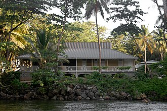
Rosalie is a village in Dominica. It is located in Saint David Parish at the northern end of Rosalie Bay, on the central east coast of the island, close to the mouth of the Rosalie River.
People
Climate
| Population | 802 |
| Population Density | 386 / sq mi |
| Elevation | 246 ft (75 m) |
| Coordinates | 15.3667°, -61.2667° |
| Timezone | America/Dominica |
| Country | 🇩🇲 Dominica |
| State / Province | Saint David Parish |
| Average Temperature | 76°F (25°C) |
| January Average | 74°F (23°C) |
| July Average | 78°F (26°C) |
| Annual Precipitation | 80.5 inches (2,045 mm) |
| Annual Snowfall | 0.0 inches (0 cm) |
About Rosalie
Rosalie is a small town in Dominica (Saint David Parish) with a population of 802. The city sits at an elevation of 246 feet (75 meters) above sea level. The average annual temperature is 76°F (25°C). Temperatures range from 74°F in January to 78°F in July. Annual precipitation averages 80.5 inches. The timezone is America/Dominica.
Temperature
| Annual Average | 76.4°F |
| 41% above Dominica avg | |
| January Average | 74°F (23°C) |
| July Average | 78°F (26°C) |
| Sunny Days | 190 days/yr |
Geography
| Elevation | 246 ft (75 m) |
| Area | 2.1 sq mi (5.4 km²) |
| Population Density | 386/sq mi |
| Coordinates | 15.3667°N, 61.2667°W |
| Timezone | America/Dominica |
Precipitation & Snow
Air Quality
Tsunami History
10 tsunamis recorded within 500 km. Highest wave on record: 5.0 m (16 ft).
| Year | Location | Cause | Max Wave | Deaths | Distance |
| 1902 | MOUNT PELEE | Explosion | 5.0 m | 23 | 62 km |
| 1902 | MOUNT PELEE | Astronomical | 4.0 m | — | 62 km |
| 1902 | MOUNT PELEE | Astronomical | 3.0 m | 1,500 | 62 km |
| 2004 | BASSE-TERRE, LES SAINTES | Earthquake | 2.0 m | 1 | 59 km |
| 1902 | FORT-DE-FRANCE | Astronomical | 1.0 m | — | 88 km |
| 1902 | MARTINIQUE | Astronomical | 0.6 m | — | 95 km |
| 2005 | DOMINICA PASSAGE | Earthquake | — | — | 68 km |
| 1839 | MARTINIQUE | Earthquake | — | 390 | 88 km |
| 1823 | SAINT PIERRE | Earthquake | — | — | 111 km |
| 1767 | MARTINIQUE & BARBADOS | Earthquake | — | — | 111 km |
Nearby Volcanoes
9 volcanoes within 200 km. Closest: Trois Pitons, Morne (7 km).
| Name | Type | Elevation | Last Eruption | Distance |
| Trois Pitons, Morne | Complex | 1,387 m (4,551 ft) | 920 | 7 km |
| Watt, Morne | Stratovolcano(es) | 1,224 m (4,016 ft) | 1997 | 8 km |
| Plat Pays, Morne | Stratovolcano | 940 m (3,084 ft) | 1270 | 15 km |
| Diablotins, Morne | Stratovolcano | 1,430 m (4,692 ft) | Unknown | 21 km |
| Diables, Morne aux | Lava dome(s) | 861 m (2,825 ft) | Unknown | 32 km |
| Pelee | Stratovolcano | 1,394 m (4,573 ft) | 1932 | 63 km |
| Soufriere Guadeloupe | Stratovolcano | 1,467 m (4,813 ft) | 1977 | 87 km |
| Qualibou | Caldera | 777 m (2,549 ft) | 1766 | 173 km |
| Soufriere Hills | Stratovolcano | 915 m (3,002 ft) | 2013 | 179 km |
Monthly Weather
| Month | Avg Temperature | Precipitation | Summary |
|---|---|---|---|
| January | 74°F (23°C) | 6.5 in | Coldest |
| February | 74°F (23°C) | 3.9 in | |
| March | 74°F (24°C) | 3.4 in | Driest |
| April | 76°F (24°C) | 3.5 in | |
| May | 77°F (25°C) | 5.2 in | |
| June | 78°F (26°C) | 6.6 in | |
| July | 78°F (26°C) | 6.5 in | |
| August | 79°F (26°C) | 8.7 in | Warmest |
| September | 78°F (26°C) | 9.1 in | |
| October | 78°F (25°C) | 8.7 in | |
| November | 76°F (25°C) | 10.1 in | Wettest |
| December | 75°F (24°C) | 8.4 in |
Rosalie has a seasonal temperature swing of 5°F / from 74°F in January to 79°F in August. Total annual precipitation is 80.5 inches, with November being the wettest month (10.1") and March the driest (3.4").
Schools in Rosalie
1 public schools (NCES 2022-23 data).
| School | Level | Enrollment | Teachers | Student/Teacher |
|---|---|---|---|---|
| Grand Fond Primary School | — | — | — | — |
Radio Stations near Rosalie
4 stations within ~55 km.
| Station | Genre | Quality | |
|---|---|---|---|
| DBS Radio | — | MP3 96 kbps | |
| Voice of Life Radio | — | MP3 128 kbps | |
| Dominica Catholic Radio | — | MP3 128 kbps | |
| En Ba Mango | — | MP3 128 kbps |
Museums in Rosalie
| Name | Type | Address | Phone | Annual Revenue |
|---|---|---|---|---|
| Dominica Museum | ||||
| Interpretation room | ||||
| Old Mill Cultural Centre |
Libraries in Rosalie
| Name | Address | Staff | Annual Visits | Circulation | Collection | Programs |
|---|---|---|---|---|---|---|
| Alliance Française | 0.0 | |||||
| Grand Bay Community Centre | 0.0 | |||||
| Marigot Library | 0.0 | |||||
| Portsmouth Public Library | 0.0 | |||||
| Roseau Public Library | 0.0 | |||||
| Ross University School of Medicine - Anne Ross Library | 0.0 | |||||
| Tunubuku Library & Computer Centre | 0.0 |
Farmers Markets in Rosalie
| Name | Address | Season | Hours | Organic | Website |
|---|---|---|---|---|---|
| Main Market | |||||
| Old Market | |||||
| Portsmouth Market |
Hotels in Rosalie
3 hotels within city radius — OpenStreetMap data
Banks in Rosalie
1 banks within city radius — OpenStreetMap data
Stadiums & Teams in Rosalie
| Team | League | Division |
|---|---|---|
Airports Near Rosalie
5 airports within the area.
| Airport | IATA | Type |
|---|---|---|
| Canefield Airport | DCF | Medium Airport |
| Douglas-Charles Airport | DOM | Medium Airport |
| Marie-Galante Airport | GBJ | Medium Airport |
| Basse-Terre Baillif Airport | BBR | Small Airport |
| Terre-de-Haut Airport | LSS | Small Airport |
UNESCO World Heritage Sites Near Rosalie
1 UNESCO sites.
| Site | Category | Year |
|---|---|---|
| Morne Trois Pitons National Park | Natural | 1997 |
Churches & Religious Organizations in Rosalie
2 religious organizations (IRS tax-exempt data).
| Name | Address |
|---|---|
| Grand_Fond_Roman Catholic Church | |
| Rosalie Diocesan Center |
Explore Near Rosalie
Quick Facts
🇩🇲 About Dominica
UNESCO World Heritage Sites Near Rosalie
Download Full City Report
Get a comprehensive, print-ready PDF with all data for Rosalie.
Get ReportFrequently Asked Questions About Rosalie
What is the population of Rosalie?
Rosalie has a population of 802 residents and is located in Dominica. The population density is 386 people per square mile, spread across 2.1 square miles.
What is the weather like in Rosalie?
Rosalie has a warm climate with an average annual temperature of 76°F (25°C). Winter temperatures average 74°F in January, while summers reach an average of 78°F in July. The area receives 190 sunny days per year. Annual rainfall totals 80.5 inches.