 All Countries


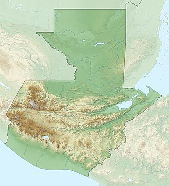
San José Ojetenán, Guatemala
San Marcos · Guatemala
San José Ojetenán is a small town in San Marcos, Guatemala with a population of 1,269. Elevation: 10,676 ft (3,254 m). Average temperature: 66°F (19°C).
Data updated June 2026
Discover San José Ojetenán, Guatemala
Explore over 40 sections covering people, economy, housing, health, crime, climate, community, costs, trends, schools, colleges, hospitals, treatment centers, industries, museums, libraries, breweries, farmers markets, grocery stores, pharmacies, campgrounds, parks, trails, stadiums, ski resorts, daycare centers, nursing homes, churches, fire stations, cell towers, bridges, power plants, EV stations, prisons, radio stations, airports, police stations, post offices, Amtrak stations, superfund sites, UNESCO sites, and more.
Use the tabs and dropdown menus below to navigate every data point we track for this city.
About San José Ojetenán
San José Ojetenán är en ort i Guatemala. Den ligger i departementet Departamento de San Marcos, i den västra delen av landet, 170 km väster om huvudstaden Guatemala City. San José Ojetenán ligger 3 254 meter över havet och antalet invånare är 1 269.
People
Climate
| Population | 1,269 |
| Population Density | 6 / sq mi |
| Elevation | 10,676 ft (3,254 m) |
| Coordinates | 15.2167°, -91.9667° |
| Timezone | America/Guatemala |
| Country | 🇬🇹 Guatemala |
| State / Province | San Marcos |
| Average Temperature | 66°F (19°C) |
| January Average | 63°F (17°C) |
| July Average | 67°F (19°C) |
| Annual Precipitation | 108.9 inches (2,765 mm) |
| Annual Snowfall | 0.0 inches (0 cm) |
About San José Ojetenán
San José Ojetenán is a small town in Guatemala (San Marcos) with a population of 1,269. The city sits at an elevation of 10,676 feet (3,254 meters) above sea level. The average annual temperature is 66°F (19°C). Temperatures range from 63°F in January to 67°F in July. Annual precipitation averages 108.9 inches. The timezone is America/Guatemala.
Temperature
| Annual Average | 65.6°F |
| 21% above Guatemala avg | |
| January Average | 63°F (17°C) |
| July Average | 67°F (19°C) |
| Sunny Days | 357 days/yr |
Geography
| Elevation | 10,676 ft (3,254 m) |
| Area | 204.9 sq mi (530.8 km²) |
| Population Density | 6/sq mi |
| Coordinates | 15.2167°N, 91.9667°W |
| Timezone | America/Guatemala |
Precipitation & Snow
Air Quality
Tsunami History
3 tsunamis recorded within 500 km. Highest wave on record: 4.0 m (13 ft).
| Year | Location | Cause | Max Wave | Deaths | Distance |
| 2005 | LAGO DE ATITLAN | Meteorological | 4.0 m | — | 100 km |
| 2012 | GUATEMALA | Earthquake | 0.4 m | 48 | 137 km |
| 1950 | GUATEMALA | Earthquake | 0.2 m | — | 101 km |
Nearby Volcanoes
9 volcanoes within 200 km. Closest: Tacana (18 km).
| Name | Type | Elevation | Last Eruption | Distance |
| Tacana | Stratovolcano | 4,064 m (13,333 ft) | 1986 | 18 km |
| Almolonga | Stratovolcano | 3,173 m (10,410 ft) | 1818 | 67 km |
| Santa Maria | Stratovolcano | 3,745 m (12,287 ft) | 2020 | 68 km |
| Toliman | Stratovolcano(es) | 3,158 m (10,361 ft) | Unknown | 107 km |
| Acatenango | Stratovolcano(es) | 3,976 m (13,045 ft) | 1972 | 142 km |
| Fuego | Stratovolcano(es) | 3,763 m (12,346 ft) | 2020 | 143 km |
| Agua | Stratovolcano | 3,760 m (12,336 ft) | Unknown | 156 km |
| Pacaya | Complex | 2,569 m (8,428 ft) | 2020 | 174 km |
| Cuilapa-Barbarena | Volcanic field | 1,454 m (4,770 ft) | Unknown | 195 km |
Monthly Weather
| Month | Avg Temperature | Precipitation | Summary |
|---|---|---|---|
| January | 63°F (17°C) | 0.2 in | Driest |
| February | 52°F (11°C) | 0.3 in | |
| March | 54°F (12°C) | 0.9 in | |
| April | 56°F (13°C) | 2.0 in | |
| May | 56°F (13°C) | 7.2 in | |
| June | 56°F (13°C) | 11.3 in | Wettest |
| July | 67°F (19°C) | 7.4 in | Warmest |
| August | 55°F (13°C) | 8.4 in | |
| September | 55°F (13°C) | 11.3 in | |
| October | 54°F (12°C) | 6.9 in | |
| November | 52°F (11°C) | 1.3 in | |
| December | 51°F (11°C) | 0.5 in | Coldest |
San José Ojetenán has a seasonal temperature swing of 16°F / from 51°F in December to 67°F in July. Total annual precipitation is 57.7 inches, with June being the wettest month (11.3") and January the driest (0.2").
Radio Stations near San José Ojetenán
7 stations within ~55 km.
| Station | Genre | Quality | |
|---|---|---|---|
| Stereo 100, Quetzaltenango | latin pop, local news | AAC 64 kbps | |
| BELLA MÚSICA 106.7 (Tapachula) - 106.7 FM - XHTPC-FM - Valanci Media Group - Tapachula, Chiapas (MX) | 106.7 fm, américa | AAC | |
| Bella Música (Tapachula) - 106.7 FM - XHTPC-FM - Grupo Radio Digital - Tapachula, Chiapas (MX) | 106.7 fm, baladas | AAC | |
| W RADIO 91.5 (Tapachula) - 91.5 FM - XHTAC-FM - Grupo Radio Cañón - Tapachula, Chiapas (MX) | 91.5 fm, américa | MP3 128 kbps | |
| LOS40 Tapachula - 99.5 FM - XHEZZZ-FM- Radio Núcleo - Tapachula, Chiapas (MX) | 99.5 fm, américa | MP3 192 kbps | |
| RADIO ESLA | — | AAC | |
| Dinámica 89.9 FM | entretenimiento, latino | MP3 128 kbps |
Museums in San José Ojetenán
| Name | Type | Address | Phone | Annual Revenue |
|---|---|---|---|---|
| Casa de Cultura |
Libraries in San José Ojetenán
| Name | Address | Staff | Annual Visits | Circulation | Collection | Programs |
|---|---|---|---|---|---|---|
| Biblioteca | 0.0 |
Farmers Markets in San José Ojetenán
| Name | Address | Season | Hours | Organic | Website |
|---|---|---|---|---|---|
| MERCADO MUNICIPAL | |||||
| Mercado Municipal de Cacahoatán | |||||
| Mercado no. 1 | |||||
| Terminal Market |
Stadiums & Teams in San José Ojetenán
| Team | League | Division |
|---|---|---|
Airports Near San José Ojetenán
25 airports within the area.
| Airport | IATA | Type |
|---|---|---|
| Retalhuleu Airport | RER | Medium Airport |
| Tapachula International Airport | TAP | Medium Airport |
| Aeródromo Erendira | — | Small Airport |
| Aeródromo La Base | — | Small Airport |
| Algodonera de Tapachula Airport | — | Small Airport |
| Barillas upper | — | Small Airport |
| Buenos Aires 2 Airstrip | — | Small Airport |
| Coatepeque Airport | CTF | Small Airport |
| El Hato Airport | — | Small Airport |
| El Paraiso Villalobos Airport | — | Small Airport |
| El Paso del Aguila Airport | — | Small Airport |
| Finca El Alamo Airport | — | Small Airport |
| Huehuetenango Airport | HUG | Small Airport |
| Ingenio de Huixtla Airport | — | Small Airport |
| La Valentina Airport | — | Small Airport |
| Los Torres Airport | — | Small Airport |
| Malacatán Airport | — | Small Airport |
| Marte R. Gomez Airport | — | Small Airport |
| Murallas Airport | — | Small Airport |
| Quezaltenango Airport | AAZ | Small Airport |
| San Marcos Airport | — | Small Airport |
| Santa Teresa Airport | — | Small Airport |
| Santiago Airport | — | Small Airport |
| Santo Tomas Airport | — | Small Airport |
| Valle de Tapachula Airport | — | Small Airport |
Quick Facts
🇬🇹 About Guatemala
Public Holidays in Guatemala
13 public holidays this year
Download Full City Report
Get a comprehensive, print-ready PDF with all data for San José Ojetenán.
Get ReportFrequently Asked Questions About San José Ojetenán
What is the population of San José Ojetenán?
San José Ojetenán has a population of 1,269 residents and is located in Guatemala. The population density is 6 people per square mile, spread across 204.9 square miles.
What is the weather like in San José Ojetenán?
San José Ojetenán enjoys a temperate climate with an average annual temperature of 66°F (19°C). Winter temperatures average 63°F in January, while summers reach an average of 67°F in July. The area receives 357 sunny days per year, well above the national average of 205. Annual rainfall totals 108.9 inches.