 All Countries


Sandy Point Town, Saint Kitts and Nevis
Saint Anne Sandy Point · Saint Kitts and Nevis
Sandy Point Town is a small town in Saint Anne Sandy Point, Saint Kitts and Nevis with a population of 3,140. Elevation: 75 ft (23 m). Average temperature: 79°F (26°C).
Discover Sandy Point Town, Saint Kitts and Nevis
Explore over 40 sections covering people, economy, housing, health, crime, climate, community, costs, trends, schools, colleges, hospitals, treatment centers, industries, museums, libraries, breweries, farmers markets, grocery stores, pharmacies, campgrounds, parks, trails, stadiums, ski resorts, daycare centers, nursing homes, churches, fire stations, cell towers, bridges, power plants, EV stations, prisons, radio stations, airports, police stations, post offices, Amtrak stations, superfund sites, UNESCO sites, and more.
Use the tabs and dropdown menus below to navigate every data point we track for this city.
About Sandy Point Town
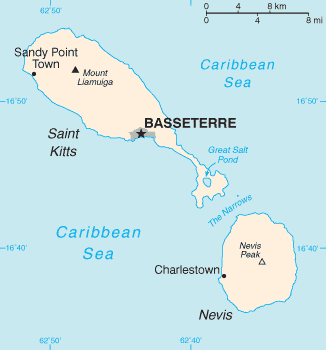
Sandy Point is the second-largest town on the island of Saint Kitts, Saint Kitts and Nevis. The settlement is situated on the north-west coast of St. Kitts and is the capital of Saint Anne Sandy Point Parish. As of 2011, it had a population of 2,626.
People
Climate
| Population | 3,140 |
| Population Density | 1,256 / sq mi |
| Elevation | 75 ft (23 m) |
| Coordinates | 17.3591°, -62.8486° |
| Timezone | America/St_Kitts |
| Country | 🇰🇳 Saint Kitts and Nevis |
| State / Province | Saint Anne Sandy Point |
| Average Temperature | 79°F (26°C) |
| January Average | 76°F (25°C) |
| July Average | 81°F (27°C) |
| Annual Precipitation | 50.7 inches (1,287 mm) |
| Annual Snowfall | 0.0 inches (0 cm) |
About Sandy Point Town
Sandy Point Town is a small town in Saint Kitts and Nevis (Saint Anne Sandy Point) with a population of 3,140. The city sits at an elevation of 75 feet (23 meters) above sea level. The average annual temperature is 79°F (26°C). Temperatures range from 76°F in January to 81°F in July. Annual precipitation averages 50.7 inches. The timezone is America/St_Kitts.
Temperature
| Annual Average | 79.0°F |
| 46% above Saint Kitts and Nevis avg | |
| January Average | 76°F (25°C) |
| July Average | 81°F (27°C) |
| Sunny Days | 244 days/yr |
Geography
| Elevation | 75 ft (23 m) |
| Area | 2.5 sq mi (6.5 km²) |
| Population Density | 1,256/sq mi |
| Coordinates | 17.3591°N, 62.8486°W |
| Timezone | America/St_Kitts |
Precipitation & Snow
Air Quality
Tsunami History
7 tsunamis recorded within 500 km. Highest wave on record: 4.0 m (13 ft).
| Year | Location | Cause | Max Wave | Deaths | Distance |
| 2003 | SOUFRIERE HILLS VOLCANO | Astronomical | 4.0 m | — | 100 km |
| 1997 | WHITE RIVER VALLEY | Explosion | 3.0 m | — | 101 km |
| 1999 | SOUFRIERE HILLS VOLCANO | Astronomical | 2.0 m | — | 100 km |
| 1843 | POINTE-A-PITRE | Earthquake | 1.2 m | 5,000 | 118 km |
| 2006 | SOUFRIERE HILLS VOLCANO | Astronomical | 1.0 m | — | 100 km |
| 1985 | GUADELOUPE | Earthquake | 0.1 m | — | 57 km |
| 1690 | ANTIGUA; SAINT KITTS AND NEVIS | Earthquake | — | — | 144 km |
Nearby Volcanoes
6 volcanoes within 200 km. Closest: Liamuiga (5 km).
| Name | Type | Elevation | Last Eruption | Distance |
| Liamuiga | Stratovolcano | 1,156 m (3,793 ft) | 160 | 5 km |
| Quill, The | Stratovolcano | 601 m (1,972 ft) | 250 | 18 km |
| Nevis Peak | Stratovolcano | 985 m (3,232 ft) | Unknown | 37 km |
| Saba | Stratovolcano | 887 m (2,910 ft) | 1640 | 50 km |
| Soufriere Hills | Stratovolcano | 915 m (3,002 ft) | 2013 | 101 km |
| Soufriere Guadeloupe | Stratovolcano | 1,467 m (4,813 ft) | 1977 | 193 km |
Monthly Weather
| Month | Avg Temperature | Precipitation | Summary |
|---|---|---|---|
| January | 76°F (25°C) | 3.2 in | Coldest |
| February | 76°F (25°C) | 2.0 in | Driest |
| March | 77°F (25°C) | 2.2 in | |
| April | 78°F (26°C) | 3.1 in | |
| May | 80°F (27°C) | 4.5 in | |
| June | 81°F (27°C) | 4.1 in | |
| July | 81°F (27°C) | 4.4 in | |
| August | 82°F (28°C) | 6.0 in | Warmest |
| September | 81°F (27°C) | 6.2 in | Wettest |
| October | 80°F (27°C) | 5.7 in | |
| November | 79°F (26°C) | 5.8 in | |
| December | 77°F (25°C) | 3.6 in |
Sandy Point Town has a seasonal temperature swing of 5°F / from 76°F in January to 82°F in August. Total annual precipitation is 50.7 inches, with September being the wettest month (6.2") and February the driest (2.0").
Schools in Sandy Point Town
6 public schools (NCES 2022-23 data).
| School | Level | Enrollment | Teachers | Student/Teacher |
|---|---|---|---|---|
| The Sandy Point Primary School | — | — | — | — |
| The Sandy Point Preschool | — | — | — | — |
| The Charles E. Mills Secondary School | — | — | — | — |
| Heart To Heart Pre-School | — | — | — | — |
| half way tree pre-school | — | — | — | — |
| Rainbow Nursery | — | — | — | — |
Radio Stations near Sandy Point Town
4 stations within ~55 km.
| Station | Genre | Quality | |
|---|---|---|---|
| 2020 Vision Radio | — | MP3 320 kbps | |
| Praise 96.5 (US) | gospel | AAC+ 32 kbps | |
| Freedom 93.7 (US) | news, talk | AAC | |
| Praise 93.3 (US) | — | AAC+ 64 kbps |
Museums in Sandy Point Town
| Name | Type | Address | Phone | Annual Revenue |
|---|---|---|---|---|
| Berkel's Family Museum | ||||
| Museum of Nevis History | ||||
| Museum of Nevis History | ||||
| Museum of Nevis History | ||||
| National Museum | ||||
| Nevis Sports Museum | ||||
| St. Eustatius Museum |
Libraries in Sandy Point Town
| Name | Address | Staff | Annual Visits | Circulation | Collection | Programs |
|---|---|---|---|---|---|---|
| Sandy Point Library | 0.0 |
Farmers Markets in Sandy Point Town
| Name | Address | Season | Hours | Organic | Website |
|---|---|---|---|---|---|
| Amory's Mall | |||||
| Old Fish Market | |||||
| Public Market | |||||
| Sandy Point Market |
Restaurants in Sandy Point Town
3 restaurants within city radius — OpenStreetMap data
Theme Parks in Sandy Point Town
1 theme parks within city radius — OpenStreetMap data
Gas Stations in Sandy Point Town
1 gas stations within city radius — OpenStreetMap data
Banks in Sandy Point Town
1 banks within city radius — OpenStreetMap data
Stadiums & Teams in Sandy Point Town
| Team | League | Division |
|---|---|---|
Airports Near Sandy Point Town
8 airports within the area.
| Airport | IATA | Type |
|---|---|---|
| John A. Osborne Airport | MNI | Large Airport |
| Princess Juliana International Airport | SXM | Large Airport |
| Robert L. Bradshaw International Airport | SKB | Large Airport |
| F. D. Roosevelt Airport | EUX | Medium Airport |
| Grand Case-l'Espérance Airport | SFG | Medium Airport |
| Juancho E. Yrausquin Airport | SAB | Medium Airport |
| St. Jean Airport | SBH | Medium Airport |
| Vance W. Amory International Airport | NEV | Medium Airport |
Post Offices in Sandy Point Town
1 post offices.
| Post Office | Address |
|---|---|
| Sandy Point Post Office |
UNESCO World Heritage Sites Near Sandy Point Town
1 UNESCO sites.
| Site | Category | Year |
|---|---|---|
| Brimstone Hill Fortress National Park | Cultural | 1999 |
Churches & Religious Organizations in Sandy Point Town
17 religious organizations (IRS tax-exempt data).
| Name | Address |
|---|---|
| Abundant Life (transformation ministry | |
| Anglican Church Hall | |
| Apostolic faith church | |
| Bethany Gospel Hall | |
| Calvery Baptist Church | |
| Church Of Nazareth | |
| First Gospel | |
| Methodist Church | |
| Methodist Church Hall | |
| Sacred Heart Catholic Church | |
| Seven Day Adventist | |
| The Anglican Church | |
| The Apostolic Faith | |
| The Evangelistic Faith church | |
| The Lighthouse Baptist Church | |
| Unique Touch Christian Center | |
| Wesleyan Holiness Church |
Quick Facts
🇰🇳 About Saint Kitts and Nevis
UNESCO World Heritage Sites Near Sandy Point Town
Download Full City Report
Get a comprehensive, print-ready PDF with all data for Sandy Point Town.
Get ReportFrequently Asked Questions About Sandy Point Town
What is the population of Sandy Point Town?
Sandy Point Town has a population of 3,140 residents and is located in Saint Kitts and Nevis. The population density is 1,256 people per square mile, spread across 2.5 square miles.
What is the weather like in Sandy Point Town?
Sandy Point Town has a warm climate with an average annual temperature of 79°F (26°C). Winter temperatures average 76°F in January, while summers reach an average of 81°F in July. The area receives 244 sunny days per year. Annual rainfall totals 50.7 inches.