 All Countries


Santa Ana, Guatemala
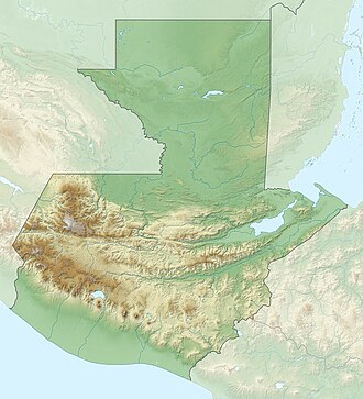
Petén · Guatemala
Santa Ana is a small city in Petén, Guatemala with a population of 9,523. Elevation: 686 ft (209 m). Average temperature: 78°F (25°C).
Data updated June 2026
Discover Santa Ana, Guatemala
Explore over 40 sections covering people, economy, housing, health, crime, climate, community, costs, trends, schools, colleges, hospitals, treatment centers, industries, museums, libraries, breweries, farmers markets, grocery stores, pharmacies, campgrounds, parks, trails, stadiums, ski resorts, daycare centers, nursing homes, churches, fire stations, cell towers, bridges, power plants, EV stations, prisons, radio stations, airports, police stations, post offices, Amtrak stations, superfund sites, UNESCO sites, and more.
Use the tabs and dropdown menus below to navigate every data point we track for this city.
About Santa Ana
Santa Ana är en kommunhuvudort i Guatemala. Den ligger i kommunen Municipio de Santa Ana och departementet Petén, i den norra delen av landet, 250 km norr om huvudstaden Guatemala City. Santa Ana ligger 213 meter över havet och antalet invånare är 9 523.
People
Climate
| Population | 9,523 |
| Population Density | 26 / sq mi |
| Elevation | 686 ft (209 m) |
| Coordinates | 16.8058°, -89.8271° |
| Timezone | America/Guatemala |
| Country | 🇬🇹 Guatemala |
| State / Province | Petén |
| Average Temperature | 78°F (25°C) |
| January Average | 72°F (22°C) |
| July Average | 79°F (26°C) |
| Annual Precipitation | 86.4 inches (2,194 mm) |
| Annual Snowfall | 0.0 inches (0 cm) |
About Santa Ana
Santa Ana is a small city in Guatemala (Petén) with a population of 9,523. The city sits at an elevation of 686 feet (209 meters) above sea level. The average annual temperature is 78°F (25°C). Temperatures range from 72°F in January to 79°F in July. Annual precipitation averages 86.4 inches. The timezone is America/Guatemala.
Temperature
| Annual Average | 77.5°F |
| 44% above Guatemala avg | |
| January Average | 72°F (22°C) |
| July Average | 79°F (26°C) |
| Sunny Days | 179 days/yr |
Geography
| Elevation | 686 ft (209 m) |
| Area | 366.0 sq mi (948.0 km²) |
| Population Density | 26/sq mi |
| Coordinates | 16.8058°N, 89.8271°W |
| Timezone | America/Guatemala |
Precipitation & Snow
Air Quality
Monthly Weather
| Month | Avg Temperature | Precipitation | Summary |
|---|---|---|---|
| January | 72°F (22°C) | 4.1 in | Coldest |
| February | 74°F (23°C) | 3.0 in | |
| March | 77°F (25°C) | 2.5 in | |
| April | 81°F (27°C) | 1.9 in | Driest |
| May | 82°F (28°C) | 5.6 in | Warmest |
| June | 81°F (27°C) | 12.0 in | |
| July | 79°F (26°C) | 12.6 in | Wettest |
| August | 79°F (26°C) | 11.1 in | |
| September | 79°F (26°C) | 12.0 in | |
| October | 78°F (25°C) | 10.0 in | |
| November | 75°F (24°C) | 6.6 in | |
| December | 73°F (23°C) | 5.2 in |
Santa Ana has a seasonal temperature swing of 9°F / from 72°F in January to 82°F in May. Total annual precipitation is 86.4 inches, with July being the wettest month (12.6") and April the driest (1.9").
Schools in Santa Ana
3 public schools (NCES 2022-23 data).
| School | Level | Enrollment | Teachers | Student/Teacher |
|---|---|---|---|---|
| EsCuela Oficial Urbasna Mixta Prof Samuel Ochaeta Serrano | — | — | — | — |
| Escuela Oficial Rural Mixtas Barrio La Calzada | — | — | — | — |
| Escuela Rural Buena Vista | — | — | — | — |
Museums in Santa Ana
| Name | Type | Address | Phone | Annual Revenue |
|---|---|---|---|---|
| Museo de San Miguel | ||||
| Museo El Petencito | ||||
| Museo Nueva Horizonte |
Libraries in Santa Ana
| Name | Address | Staff | Annual Visits | Circulation | Collection | Programs |
|---|---|---|---|---|---|---|
| Biblioteca CUDEP | 0.0 | |||||
| Biblioteca Municipal | 0.0 | |||||
| Biblioteca Municipal | 0.0 |
Farmers Markets in Santa Ana
| Name | Address | Season | Hours | Organic | Website |
|---|---|---|---|---|---|
| Disagro Santa Elena | |||||
| Mercado Central | |||||
| Mercado Municipal | |||||
| Mercado Municipal San Benito | |||||
| Mercado Nuevo | |||||
| Santa Elena Market |
Restaurants in Santa Ana
2 restaurants within city radius — OpenStreetMap data
Veterinaries in Santa Ana
1 veterinaries within city radius — OpenStreetMap data
Gas Stations in Santa Ana
3 gas stations within city radius — OpenStreetMap data
Stadiums & Teams in Santa Ana
| Team | League | Division |
|---|---|---|
Airports Near Santa Ana
10 airports within the area.
| Airport | IATA | Type |
|---|---|---|
| Mundo Maya International Airport | FRS | Medium Airport |
| Carmelita Airport | CMM | Small Airport |
| La Libertad Airport | — | Small Airport |
| Macanche Airport | — | Small Airport |
| Paso Caballos Airport | PCG | Small Airport |
| Poptún Airport | PON | Small Airport |
| San Ignacio Town (Maya Flats) Airstrip | CYD | Small Airport |
| Sayaxché Airport | — | Small Airport |
| Tikindustrias Airport | — | Small Airport |
| Uaxactun Airport | UAX | Small Airport |
Churches & Religious Organizations in Santa Ana
1 religious organizations (IRS tax-exempt data).
| Name | Address |
|---|---|
| Iglesia Católica- Santa Ana |
Quick Facts
🇬🇹 About Guatemala
Public Holidays in Guatemala
13 public holidays this year
Download Full City Report
Get a comprehensive, print-ready PDF with all data for Santa Ana.
Get ReportFrequently Asked Questions About Santa Ana
What is the population of Santa Ana?
Santa Ana has a population of 9,523 residents and is located in Guatemala. The population density is 26 people per square mile, spread across 366.0 square miles.
What is the weather like in Santa Ana?
Santa Ana has a warm climate with an average annual temperature of 78°F (25°C). Winter temperatures average 72°F in January, while summers reach an average of 79°F in July. The area receives 179 sunny days per year, below the national average of 205. Annual rainfall totals 86.4 inches.