 All Countries


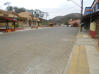
Santa Rita de Jacutinga, Brazil
Minas Gerais · Brazil
Santa Rita de Jacutinga is a small town in Minas Gerais, Brazil with a population of 4,755. Elevation: 1,870 ft (570 m). Average temperature: 78°F (25°C).
Discover Santa Rita de Jacutinga, Brazil
Explore over 40 sections covering people, economy, housing, health, crime, climate, community, costs, trends, schools, colleges, hospitals, treatment centers, industries, museums, libraries, breweries, farmers markets, grocery stores, pharmacies, campgrounds, parks, trails, stadiums, ski resorts, daycare centers, nursing homes, churches, fire stations, cell towers, bridges, power plants, EV stations, prisons, radio stations, airports, police stations, post offices, Amtrak stations, superfund sites, UNESCO sites, and more.
Use the tabs and dropdown menus below to navigate every data point we track for this city.
About Santa Rita de Jacutinga
Santa Rita de Jacutinga is a municipality in the state of Minas Gerais in the Southeast region of Brazil.
People
Economy
C+Climate
| Population | 4,755 |
| Population Density | 24 / sq mi |
| Elevation | 1,870 ft (570 m) |
| Coordinates | -22.1494°, -44.0950° |
| Timezone | America/Sao_Paulo |
| Country | 🇧🇷 Brazil |
| State / Province | Minas Gerais |
| Average Temperature | 78°F (25°C) |
| January Average | 80°F (27°C) |
| July Average | 71°F (22°C) |
| Annual Precipitation | 70.5 inches (1,790 mm) |
| Annual Snowfall | 0.0 inches (0 cm) |
| Median Household Income | $2,170 |
About Santa Rita de Jacutinga
Santa Rita de Jacutinga is a small town in Brazil (Minas Gerais) with a population of 4,755. The city sits at an elevation of 1,870 feet (570 meters) above sea level. The average annual temperature is 78°F (25°C). Temperatures range from 80°F in January to 71°F in July. Annual precipitation averages 70.5 inches. The timezone is America/Sao_Paulo.
Income: Santa Rita de Jacutinga vs Brazil
Commute Mode
Income
| Median HH Income | $2,170 |
| 97% below Brazil avg |
Employment & Poverty
| Establishments (County) | 81 |
Business (County)
Tax & Cost of Living
Commute & Transportation
Walkability
Temperature
| Annual Average | 77.5°F |
| 44% above Brazil avg | |
| January Average | 80°F (27°C) |
| July Average | 71°F (22°C) |
| Sunny Days | 304 days/yr |
Geography
| Elevation | 1,870 ft (570 m) |
| Area | 199.3 sq mi (516.1 km²) |
| Population Density | 24/sq mi |
| Coordinates | -22.1494°N, 44.0950°W |
| Timezone | America/Sao_Paulo |
Precipitation & Snow
Air Quality
Monthly Weather
| Month | Avg Temperature | Precipitation | Summary |
|---|---|---|---|
| January | 80°F (27°C) | 9.9 in | Warmest |
| February | 71°F (22°C) | 8.3 in | |
| March | 70°F (21°C) | 6.9 in | |
| April | 67°F (19°C) | 3.0 in | |
| May | 63°F (17°C) | 1.5 in | |
| June | 60°F (16°C) | 0.8 in | Coldest |
| July | 71°F (22°C) | 0.7 in | Driest |
| August | 62°F (17°C) | 0.9 in | |
| September | 64°F (18°C) | 2.3 in | |
| October | 67°F (19°C) | 4.8 in | |
| November | 68°F (20°C) | 7.0 in | |
| December | 70°F (21°C) | 10.4 in | Wettest |
Santa Rita de Jacutinga has a seasonal temperature swing of 20°F / from 60°F in June to 80°F in January. Total annual precipitation is 56.3 inches, with December being the wettest month (10.4") and July the driest (0.7").
Museums in Santa Rita de Jacutinga
| Name | Type | Address | Phone | Annual Revenue |
|---|---|---|---|---|
| Museu de Arantina |
Restaurants in Santa Rita de Jacutinga
2 restaurants within city radius — OpenStreetMap data
Monuments in Santa Rita de Jacutinga
2 monuments within city radius — OpenStreetMap data
Bus Stations in Santa Rita de Jacutinga
1 bus stations within city radius — OpenStreetMap data
Gas Stations in Santa Rita de Jacutinga
3 gas stations within city radius — OpenStreetMap data
Airports Near Santa Rita de Jacutinga
11 airports within the area.
| Airport | IATA | Type |
|---|---|---|
| Campo Délio Jardim de Mattos Airport | — | Medium Airport |
| Francisco de Assis Airport | JDF | Medium Airport |
| Carolina de Assis Repetto Airport | — | Small Airport |
| Coronel Newton Braga Airport | — | Small Airport |
| Fazenda Oriente Airport | — | Small Airport |
| Fazenda Piloto Padrão KKS37/3 Airstrip | — | Small Airport |
| Fazenda Recanto Feliz Airport | — | Small Airport |
| Fazenda Recreio Airport | — | Small Airport |
| Fazenda Ribeirão Airport | — | Small Airport |
| Resende Airport | REZ | Small Airport |
| Sítio Ouro Preto Airport | — | Small Airport |
Churches & Religious Organizations in Santa Rita de Jacutinga
1 religious organizations (IRS tax-exempt data).
| Name | Address |
|---|---|
| Igrejinha do Alto |
Explore Near Santa Rita de Jacutinga
Quick Facts
🇧🇷 About Brazil
Public Holidays in Brazil
15 public holidays this year
Download Full City Report
Get a comprehensive, print-ready PDF with all data for Santa Rita de Jacutinga.
Get ReportFrequently Asked Questions About Santa Rita de Jacutinga
What is the population of Santa Rita de Jacutinga?
Santa Rita de Jacutinga has a population of 4,755 residents and is located in Brazil. The population density is 24 people per square mile, spread across 199.3 square miles.
Is Santa Rita de Jacutinga expensive to live in?
The median household income is $2,170, 97% below the national average of $75,149.
What is the weather like in Santa Rita de Jacutinga?
Santa Rita de Jacutinga has a warm climate with an average annual temperature of 78°F (25°C). Winter temperatures average 80°F in January, while summers reach an average of 71°F in July. The area receives 304 sunny days per year, well above the national average of 205. Annual rainfall totals 70.5 inches.
How is the job market in Santa Rita de Jacutinga?
There are 81 business establishments in the area.