 All Countries


Sông Cầu, Vietnam
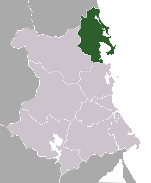
Dak Lak · Vietnam
Sông Cầu is a mid-size city in Dak Lak, Vietnam with a population of 94,066. Elevation: 33 ft (10 m). Average temperature: 79°F (26°C).
Discover Sông Cầu, Vietnam
Explore over 40 sections covering people, economy, housing, health, crime, climate, community, costs, trends, schools, colleges, hospitals, treatment centers, industries, museums, libraries, breweries, farmers markets, grocery stores, pharmacies, campgrounds, parks, trails, stadiums, ski resorts, daycare centers, nursing homes, churches, fire stations, cell towers, bridges, power plants, EV stations, prisons, radio stations, airports, police stations, post offices, Amtrak stations, superfund sites, UNESCO sites, and more.
Use the tabs and dropdown menus below to navigate every data point we track for this city.
About Sông Cầu
Sông Cầu is a former town of Phú Yên province in the South Central Coast region of Vietnam.
People
Climate
| Population | 94,066 |
| Population Density | 1,767 / sq mi |
| Elevation | 33 ft (10 m) |
| Coordinates | 13.4556°, 109.2235° |
| Timezone | Asia/Ho_Chi_Minh |
| Country | 🇻🇳 Vietnam |
| State / Province | Dak Lak |
| Average Temperature | 79°F (26°C) |
| January Average | 73°F (23°C) |
| July Average | 84°F (29°C) |
| Annual Precipitation | 55.5 inches (1,410 mm) |
| Annual Snowfall | 0.0 inches (0 cm) |
About Sông Cầu
Sông Cầu is a mid-size city in Vietnam (Dak Lak) with a population of 94,066. The city sits at an elevation of 33 feet (10 meters) above sea level. The average annual temperature is 79°F (26°C). Temperatures range from 73°F in January to 84°F in July. Annual precipitation averages 55.5 inches. The timezone is Asia/Ho_Chi_Minh.
Climate in Sông Cầu
Sông Cầu has an average annual temperature of 27.9°C (82°F). The hottest month is Jun (31.2°C), the coldest is Jan (23.9°C). Average annual precipitation is 1952 mm.
Temperature
| Annual Average | 79.3°F |
| 47% above Vietnam avg | |
| January Average | 73°F (23°C) |
| July Average | 84°F (29°C) |
| Sunny Days | 238 days/yr |
Geography
| Elevation | 33 ft (10 m) |
| Area | 53.2 sq mi (137.9 km²) |
| Population Density | 1,767/sq mi |
| Coordinates | 13.4556°N, 109.2235°W |
| Timezone | Asia/Ho_Chi_Minh |
Precipitation & Snow
Air Quality
Monthly Weather
| Month | Avg Temperature | Precipitation | Summary |
|---|---|---|---|
| January | 73°F (23°C) | 1.7 in | Coldest |
| February | 75°F (24°C) | 0.9 in | |
| March | 78°F (26°C) | 0.8 in | Driest |
| April | 81°F (27°C) | 1.8 in | |
| May | 83°F (28°C) | 3.6 in | |
| June | 84°F (29°C) | 2.1 in | Warmest |
| July | 84°F (29°C) | 2.4 in | |
| August | 83°F (29°C) | 3.3 in | |
| September | 81°F (27°C) | 8.7 in | |
| October | 79°F (26°C) | 14.0 in | Wettest |
| November | 76°F (25°C) | 12.1 in | |
| December | 74°F (23°C) | 4.4 in |
Sông Cầu has a seasonal temperature swing of 11°F / from 73°F in January to 84°F in June. Total annual precipitation is 55.5 inches, with October being the wettest month (14.0") and March the driest (0.8").
Schools in Sông Cầu
5 public schools (NCES 2022-23 data).
| School | Level | Enrollment | Teachers | Student/Teacher |
|---|---|---|---|---|
| Trường Tiểu học và Trung học cơ sở Lê Quý Đôn | — | — | — | — |
| Trường Tiểu học & Trung học cơ sở Lê Thánh Tông | — | — | — | — |
| Trường Trung học cơ sở Mạc Đỉnh Chi | — | — | — | — |
| Trường Trung học phổ thông Phan Đình Phùng | — | — | — | — |
| Trường Tiểu học Xuân Phú | — | — | — | — |
Radio Stations near Sông Cầu
0 stations within ~55 km.
| Station | Genre | Quality |
|---|
Museums in Sông Cầu
| Name | Type | Address | Phone | Annual Revenue |
|---|---|---|---|---|
| Địa Đạo Gò Thì Thùng |
Farmers Markets in Sông Cầu
| Name | Address | Season | Hours | Organic | Website |
|---|---|---|---|---|---|
| Cảng cá Vũng Chao | |||||
| Chợ Chí Thạnh | |||||
| Chợ La Hai | |||||
| Chợ Ngân Sơn | |||||
| Chợ Vũng Chao | |||||
| Chợ Xuân Lộc | |||||
| Song Cau Market |
Hotels in Sông Cầu
5 hotels within city radius — OpenStreetMap data
Cafes in Sông Cầu
1 cafes within city radius — OpenStreetMap data
Monuments in Sông Cầu
2 monuments within city radius — OpenStreetMap data
Bus Stations in Sông Cầu
1 bus stations within city radius — OpenStreetMap data
Gas Stations in Sông Cầu
12 gas stations within city radius — OpenStreetMap data
Banks in Sông Cầu
1 banks within city radius — OpenStreetMap data
Stadiums & Teams in Sông Cầu
| Team | League | Division |
|---|---|---|
Airports Near Sông Cầu
2 airports within the area.
| Airport | IATA | Type |
|---|---|---|
| Dong Tac Airport | TBB | Medium Airport |
| Phu Cat Airport | UIH | Medium Airport |
Post Offices in Sông Cầu
1 post offices.
| Post Office | Address |
|---|---|
| Postoffice |
Quick Facts
Around Sông Cầu
Places within 5 km radius — OpenStreetMap data
Things to See Near Sông Cầu
9 places within 15 km
- • Bãi biển Gành Đỏ
- • Bãi trước Từ Nham
- • Hòn Tắc
- • Núi Mô Cheo
- • Great View of the River and Mountains
- • Great Views as You Cross the Bridge
- • View of the Bay
- • View of the Bay
- • Viewpoint
🇻🇳 About Vietnam
Public Holidays in Vietnam
4 public holidays this year
Download Full City Report
Get a comprehensive, print-ready PDF with all data for Sông Cầu.
Get ReportFrequently Asked Questions About Sông Cầu
What is the population of Sông Cầu?
Sông Cầu has a population of 94,066 residents and is located in Vietnam. The population density is 1,767 people per square mile, spread across 53.2 square miles.
What is the weather like in Sông Cầu?
Sông Cầu has a warm climate with an average annual temperature of 79°F (26°C). Winter temperatures average 73°F in January, while summers reach an average of 84°F in July. The area receives 238 sunny days per year. Annual rainfall totals 55.5 inches.