 All Countries


Zébizékou, Ivory Coast
Gôh-Djiboua · Ivory Coast
Zébizékou is a small town in Gôh-Djiboua, Ivory Coast with a population of 1,449. Elevation: 827 ft (252 m). Average temperature: 78°F (26°C).
Discover Zébizékou, Ivory Coast
Explore over 40 sections covering people, economy, housing, health, crime, climate, community, costs, trends, schools, colleges, hospitals, treatment centers, industries, museums, libraries, breweries, farmers markets, grocery stores, pharmacies, campgrounds, parks, trails, stadiums, ski resorts, daycare centers, nursing homes, churches, fire stations, cell towers, bridges, power plants, EV stations, prisons, radio stations, airports, police stations, post offices, Amtrak stations, superfund sites, UNESCO sites, and more.
Use the tabs and dropdown menus below to navigate every data point we track for this city.
About Zébizékou
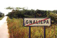
Gnaliépa est un village bété, dans l'ouest de la Côte d'Ivoire, au nord de Gagnoa dans la région du Gôh (ex-Fromager).
People
Climate
| Population | 1,449 |
| Population Density | 0 / sq mi |
| Elevation | 827 ft (252 m) |
| Coordinates | 6.3487°, -5.9406° |
| Timezone | Africa/Abidjan |
| Country | 🇨🇮 Ivory Coast |
| State / Province | Gôh-Djiboua |
| Average Temperature | 78°F (26°C) |
| January Average | 78°F (26°C) |
| July Average | 76°F (25°C) |
| Annual Precipitation | 57.4 inches (1,459 mm) |
| Annual Snowfall | 0.0 inches (0 cm) |
About Zébizékou
Zébizékou is a small town in Ivory Coast (Gôh-Djiboua) with a population of 1,449. The city sits at an elevation of 827 feet (252 meters) above sea level. The average annual temperature is 78°F (26°C). Temperatures range from 78°F in January to 76°F in July. Annual precipitation averages 57.4 inches. The timezone is Africa/Abidjan.
Climate in Zébizékou
Zébizékou has an average annual temperature of 27.4°C (81°F). The hottest month is Mar (29°C), the coldest is Aug (25.8°C). Average annual precipitation is 1479 mm.
Temperature
| Annual Average | 78.1°F |
| 45% above Ivory Coast avg | |
| January Average | 78°F (26°C) |
| July Average | 76°F (25°C) |
| Sunny Days | 322 days/yr |
Geography
| Elevation | 827 ft (252 m) |
| Area | 3,783.9 sq mi (9,800.2 km²) |
| Population Density | 0/sq mi |
| Coordinates | 6.3487°N, 5.9406°W |
| Timezone | Africa/Abidjan |
Precipitation & Snow
Air Quality
Monthly Weather
| Month | Avg Temperature | Precipitation | Summary |
|---|---|---|---|
| January | 78°F (26°C) | 0.7 in | Driest |
| February | 81°F (27°C) | 2.4 in | |
| March | 81°F (27°C) | 4.5 in | Warmest |
| April | 81°F (27°C) | 5.8 in | |
| May | 79°F (26°C) | 6.5 in | |
| June | 77°F (25°C) | 6.6 in | Wettest |
| July | 76°F (25°C) | 3.4 in | |
| August | 76°F (24°C) | 3.9 in | Coldest |
| September | 77°F (25°C) | 6.4 in | |
| October | 78°F (25°C) | 5.4 in | |
| November | 78°F (26°C) | 2.4 in | |
| December | 77°F (25°C) | 1.0 in |
Zébizékou has a seasonal temperature swing of 5°F / from 76°F in August to 81°F in March. Total annual precipitation is 48.9 inches, with June being the wettest month (6.6") and January the driest (0.7").
Schools in Zébizékou
1 public schools (NCES 2022-23 data).
| School | Level | Enrollment | Teachers | Student/Teacher |
|---|---|---|---|---|
| Groupe scolaire Public de Zebizekou | — | — | — | — |
Farmers Markets in Zébizékou
| Name | Address | Season | Hours | Organic | Website |
|---|---|---|---|---|---|
| Grand Marché Gagnoa | |||||
| Marché 1 de Guepahouo | |||||
| Marché de Bayota | |||||
| Marché de Zappata | |||||
| Marché de Zappata |
Stadiums & Teams in Zébizékou
| Team | League | Division |
|---|---|---|
| Stade BIAKA BODA de Gagnoa |
Airports Near Zébizékou
3 airports within the area.
| Airport | IATA | Type |
|---|---|---|
| Yamoussoukro International Airport | ASK | Large Airport |
| Daloa Airport | DJO | Medium Airport |
| Gagnoa Airport | GGN | Small Airport |
Treatment Centers in Zébizékou
5 treatment centers.
| Center | Type | Phone |
|---|---|---|
| Centre anti tuberculeux (CAT) | ||
| Clinique Keita | ||
| Clinique le Ghery | ||
| Clinique le samaritain | ||
| Les paracliniques des oliviers |
Quick Facts
🇨🇮 About Ivory Coast
Download Full City Report
Get a comprehensive, print-ready PDF with all data for Zébizékou.
Get ReportFrequently Asked Questions About Zébizékou
What is the population of Zébizékou?
Zébizékou has a population of 1,449 residents and is located in Ivory Coast. The population density is 0 people per square mile, spread across 3,783.9 square miles.
What is the weather like in Zébizékou?
Zébizékou has a warm climate with an average annual temperature of 78°F (26°C). Winter temperatures average 78°F in January, while summers reach an average of 76°F in July. The area receives 322 sunny days per year, well above the national average of 205. Annual rainfall totals 57.4 inches.