 All Countries


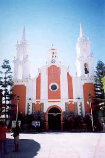
Zumpango, Mexico
Guerrero · Mexico
Zumpango is a small town in Guerrero, Mexico with a population of 1,144. Elevation: 3,845 ft (1,172 m). Average temperature: 75°F (24°C).
Discover Zumpango, Mexico
Explore over 40 sections covering people, economy, housing, health, crime, climate, community, costs, trends, schools, colleges, hospitals, treatment centers, industries, museums, libraries, breweries, farmers markets, grocery stores, pharmacies, campgrounds, parks, trails, stadiums, ski resorts, daycare centers, nursing homes, churches, fire stations, cell towers, bridges, power plants, EV stations, prisons, radio stations, airports, police stations, post offices, Amtrak stations, superfund sites, UNESCO sites, and more.
Use the tabs and dropdown menus below to navigate every data point we track for this city.
About Zumpango
Zumpango del Río is the seat of the municipality of Eduardo Neri, in the southern Mexican state of Guerrero.
People
Economy
Climate
| Population | 1,144 |
| Population Density | 3 / sq mi |
| Elevation | 3,845 ft (1,172 m) |
| Coordinates | 17.9352°, -98.6830° |
| Timezone | America/Mexico_City |
| Country | 🇲🇽 Mexico |
| State / Province | Guerrero |
| Average Temperature | 75°F (24°C) |
| January Average | 71°F (22°C) |
| July Average | 75°F (24°C) |
| Annual Precipitation | 36.4 inches (925 mm) |
| Annual Snowfall | 0.0 inches (0 cm) |
About Zumpango
Zumpango is a small town in Mexico (Guerrero) with a population of 1,144. The city sits at an elevation of 3,845 feet (1,172 meters) above sea level. The average annual temperature is 75°F (24°C). Temperatures range from 71°F in January to 75°F in July. Annual precipitation averages 36.4 inches. The timezone is America/Mexico_City.
Income: Zumpango vs Mexico
Commute Mode
Income
Employment & Poverty
| Unemployment | 0.5% |
| 86% below Mexico avg | |
| Establishments (County) | 37 |
Business (County)
Tax & Cost of Living
Commute & Transportation
Walkability
Temperature
| Annual Average | 74.5°F |
| 38% above Mexico avg | |
| January Average | 71°F (22°C) |
| July Average | 75°F (24°C) |
| Sunny Days | 270 days/yr |
Geography
| Elevation | 3,845 ft (1,172 m) |
| Area | 402.9 sq mi (1,043.5 km²) |
| Population Density | 3/sq mi |
| Coordinates | 17.9352°N, 98.6830°W |
| Timezone | America/Mexico_City |
Precipitation & Snow
Air Quality
Tsunami History
6 tsunamis recorded within 500 km. Highest wave on record: 4.0 m (13 ft).
| Year | Location | Cause | Max Wave | Deaths | Distance |
| 1820 | S. MEXICO | Earthquake | 4.0 m | — | 127 km |
| 1754 | S. MEXICO | Earthquake | 4.0 m | — | 138 km |
| 1962 | S. MEXICO | Earthquake | 0.8 m | 4 | 127 km |
| 1995 | S. MEXICO | Earthquake | 0.4 m | 3 | 129 km |
| 1962 | S. MEXICO | Earthquake | 0.3 m | 3 | 119 km |
| 2026 | ACAPULCO | Earthquake | 0.1 m | 2 | 132 km |
Nearby Volcanoes
7 volcanoes within 200 km. Closest: Popocatepetl (121 km).
| Name | Type | Elevation | Last Eruption | Distance |
| Popocatepetl | Stratovolcano(es) | 5,393 m (17,694 ft) | 2020 | 121 km |
| Chichinautzin | Volcanic field | 3,930 m (12,894 ft) | 400 | 136 km |
| Iztaccihuatl | Stratovolcano | 5,230 m (17,159 ft) | Unknown | 138 km |
| Papayo | Lava dome | 3,600 m (11,811 ft) | Unknown | 153 km |
| Toluca, Nevado de | Stratovolcano | 4,680 m (15,354 ft) | -1350 | 173 km |
| Orizaba, Pico de | Stratovolcano | 5,564 m (18,255 ft) | 1846 | 192 km |
| Serdan-Oriental | Tuff cone(s) | 3,485 m (11,434 ft) | Unknown | 196 km |
Monthly Weather
| Month | Avg Temperature | Precipitation | Summary |
|---|---|---|---|
| January | 71°F (22°C) | 0.3 in | Coldest |
| February | 73°F (23°C) | 0.2 in | |
| March | 76°F (24°C) | 0.2 in | |
| April | 79°F (26°C) | 0.7 in | |
| May | 79°F (26°C) | 2.9 in | Warmest |
| June | 76°F (25°C) | 7.4 in | |
| July | 75°F (24°C) | 7.5 in | Wettest |
| August | 75°F (24°C) | 7.2 in | |
| September | 74°F (23°C) | 7.0 in | |
| October | 74°F (23°C) | 2.5 in | |
| November | 73°F (23°C) | 0.4 in | |
| December | 71°F (22°C) | 0.1 in | Driest |
Zumpango has a seasonal temperature swing of 8°F / from 71°F in January to 79°F in May. Total annual precipitation is 36.4 inches, with July being the wettest month (7.5") and December the driest (0.1").
Airports Near Zumpango
5 airports within the area.
| Airport | IATA | Type |
|---|---|---|
| Aeródromo Santa Cruz | — | Small Airport |
| Albatros Residencial Aéreo | — | Small Airport |
| Tenango Airport | — | Small Airport |
| Tequesquitengo Airport | — | Small Airport |
| Vista Hermosa Airfield | — | Small Airport |
Quick Facts
🇲🇽 About Mexico
Public Holidays in Mexico
9 public holidays this year
Download Full City Report
Get a comprehensive, print-ready PDF with all data for Zumpango.
Get ReportFrequently Asked Questions About Zumpango
What is the population of Zumpango?
Zumpango has a population of 1,144 residents and is located in Mexico. The population density is 3 people per square mile, spread across 402.9 square miles.
What is the weather like in Zumpango?
Zumpango has a warm climate with an average annual temperature of 75°F (24°C). Winter temperatures average 71°F in January, while summers reach an average of 75°F in July. The area receives 270 sunny days per year, well above the national average of 205. Annual rainfall totals 36.4 inches.
How is the job market in Zumpango?
The job market in Zumpango is very strong, with unemployment at just 0.5% / well below the national rate of 3.6%. There are 37 business establishments in the area.