 All Countries


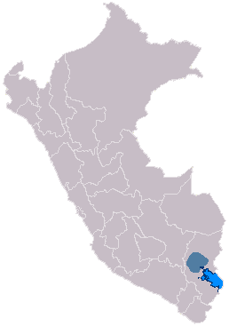
Pucará, Peru
Puno · Peru
Pucará is a small town in Puno, Peru with a population of 1,832. Elevation: 12,723 ft (3,878 m). Average temperature: 45°F (7°C).
Discover Pucará, Peru
Explore over 40 sections covering people, economy, housing, health, crime, climate, community, costs, trends, schools, colleges, hospitals, treatment centers, industries, museums, libraries, breweries, farmers markets, grocery stores, pharmacies, campgrounds, parks, trails, stadiums, ski resorts, daycare centers, nursing homes, churches, fire stations, cell towers, bridges, power plants, EV stations, prisons, radio stations, airports, police stations, post offices, Amtrak stations, superfund sites, UNESCO sites, and more.
Use the tabs and dropdown menus below to navigate every data point we track for this city.
About Pucará
The Pucará culture was an archaeological culture which developed in Qullaw, along the north-western shore of Lake Titicaca. It was characterized by a hierarchy of smaller centers and villages scattered throughout the northern basin of the Titicaca. The name originates from the town of Pukara, one of the largest settlements in the region. The modern town of Pucará is located half a mile to the east of the archaeological site. The Pukara culture is unrelated to the stone fortresses, pukaras, built across the Andes during the Inca Empire. Its sphere of influence reached as far north as the Cuzco Valley and as far south as Tiahuanaco. The culture had two phases of development within the Formative Period: the Middle Formative, and Late Formative.
People
Climate
| Population | 1,832 |
| Population Density | 9 / sq mi |
| Elevation | 12,723 ft (3,878 m) |
| Coordinates | -15.0394°, -70.3677° |
| Timezone | America/Lima |
| Country | 🇵🇪 Peru |
| State / Province | Puno |
| Average Temperature | 45°F (7°C) |
| January Average | 43°F (6°C) |
| July Average | 46°F (8°C) |
| Annual Precipitation | 41.0 inches (1,042 mm) |
| Annual Snowfall | 26.4 inches (67 cm) |
About Pucará
Pucará is a small town in Peru (Puno) with a population of 1,832. The city sits at an elevation of 12,723 feet (3,878 meters) above sea level. The average annual temperature is 45°F (7°C). Temperatures range from 43°F in January to 46°F in July. Annual precipitation averages 41.0 inches. The timezone is America/Lima.
Temperature
| Annual Average | 45.2°F |
| 16% below Peru avg | |
| January Average | 43°F (6°C) |
| July Average | 46°F (8°C) |
| Sunny Days | 361 days/yr |
Geography
| Elevation | 12,723 ft (3,878 m) |
| Area | 206.0 sq mi (533.5 km²) |
| Population Density | 9/sq mi |
| Coordinates | -15.0394°N, 70.3677°W |
| Timezone | America/Lima |
Precipitation & Snow
Air Quality
Nearby Volcanoes
4 volcanoes within 200 km. Closest: Quimsachata (143 km).
| Name | Type | Elevation | Last Eruption | Distance |
| Quimsachata | Lava dome | 3,693 m (12,116 ft) | -4450 | 143 km |
| Chachani, Nevado | Stratovolcano | 6,057 m (19,872 ft) | Unknown | 179 km |
| Sabancaya | Stratovolcano(es) | 5,960 m (19,554 ft) | 2020 | 180 km |
| Huaynaputina | Stratovolcano | 4,850 m (15,912 ft) | 1600 | 182 km |
Monthly Weather
| Month | Avg Temperature | Precipitation | Summary |
|---|---|---|---|
| January | 43°F (6°C) | 6.2 in | Wettest |
| February | 48°F (9°C) | 5.1 in | |
| March | 48°F (9°C) | 4.6 in | |
| April | 47°F (8°C) | 1.9 in | |
| May | 44°F (7°C) | 0.5 in | |
| June | 41°F (5°C) | 0.1 in | Coldest, Driest |
| July | 46°F (8°C) | 0.1 in | |
| August | 43°F (6°C) | 0.2 in | |
| September | 46°F (8°C) | 1.2 in | |
| October | 48°F (9°C) | 1.8 in | |
| November | 49°F (9°C) | 2.7 in | |
| December | 49°F (9°C) | 4.6 in | Warmest |
Pucará has a seasonal temperature swing of 8°F / from 41°F in June to 49°F in December. Total annual precipitation is 29.0 inches, with January being the wettest month (6.2") and June the driest (0.1").
Schools in Pucará
13 public schools (NCES 2022-23 data).
| School | Level | Enrollment | Teachers | Student/Teacher |
|---|---|---|---|---|
| Institución Educativa No. 70433 | — | — | — | — |
| Institución Educativa No. 70456 | — | — | — | — |
| Institución Educativa No. 70416 | — | — | — | — |
| Institución Educativa Qquepa | — | — | — | — |
| Institución Educativa No. 70457 | — | — | — | — |
| Institución Educativa No. 70800 | — | — | — | — |
| Institución Educativa No. 70417 | — | — | — | — |
| Institución Educativa No. 70394 | — | — | — | — |
| Institución Educativa Pucara | — | — | — | — |
| Ocupacional | — | — | — | — |
| Institución Educativa No. 70807 | — | — | — | — |
| Institución Educativa No. 70846 | — | — | — | — |
| Institución Educativa No. 70423 | — | — | — | — |
Museums in Pucará
| Name | Type | Address | Phone | Annual Revenue |
|---|---|---|---|---|
| Centro cultural San Juan Pablo II | ||||
| Museo Arqueológico de Pucara | ||||
| Museo de Cerámica | ||||
| Museo Litico Pukara |
Farmers Markets in Pucará
| Name | Address | Season | Hours | Organic | Website |
|---|---|---|---|---|---|
| Mercado Central | |||||
| Mercado Modelo | |||||
| Mercado Municipal PEDRO VILCAPAZA | |||||
| Mercado Municipal Santa Rosa | |||||
| Mercado Santa Rosa II |
Hotels in Pucará
1 hotels within city radius — OpenStreetMap data
Restaurants in Pucará
4 restaurants within city radius — OpenStreetMap data
Cafes in Pucará
4 cafes within city radius — OpenStreetMap data
Clinics in Pucará
1 clinics within city radius — OpenStreetMap data
Veterinaries in Pucará
1 veterinaries within city radius — OpenStreetMap data
Gas Stations in Pucará
1 gas stations within city radius — OpenStreetMap data
Stadiums & Teams in Pucará
| Team | League | Division |
|---|---|---|
Airports Near Pucará
1 airports within the area.
| Airport | IATA | Type |
|---|---|---|
| Inca Manco Capac International Airport | JUL | Large Airport |
Churches & Religious Organizations in Pucará
1 religious organizations (IRS tax-exempt data).
| Name | Address |
|---|---|
| Templo Santa Isabel |
Quick Facts
🇵🇪 About Peru
Public Holidays in Peru
14 public holidays this year
Frequently Asked Questions About Pucará
What is the population of Pucará?
Pucará has a population of 1,832 residents and is located in Peru. The population density is 9 people per square mile, spread across 206.0 square miles.
What is the weather like in Pucará?
Pucará has a cool climate with an average annual temperature of 45°F (7°C). Winter temperatures average 43°F in January, while summers reach an average of 46°F in July. The area receives 361 sunny days per year, well above the national average of 205. Annual rainfall totals 41.0 inches, with 26.4 inches of snow.