 All Countries


Tres Zapotes, Mexico
Veracruz · Mexico
Tres Zapotes is a small town in Veracruz, Mexico with a population of 3,464. Elevation: 95 ft (29 m). Average temperature: 79°F (26°C).
Data updated June 2026
Discover Tres Zapotes, Mexico
Explore over 40 sections covering people, economy, housing, health, crime, climate, community, costs, trends, schools, colleges, hospitals, treatment centers, industries, museums, libraries, breweries, farmers markets, grocery stores, pharmacies, campgrounds, parks, trails, stadiums, ski resorts, daycare centers, nursing homes, churches, fire stations, cell towers, bridges, power plants, EV stations, prisons, radio stations, airports, police stations, post offices, Amtrak stations, superfund sites, UNESCO sites, and more.
Use the tabs and dropdown menus below to navigate every data point we track for this city.
About Tres Zapotes
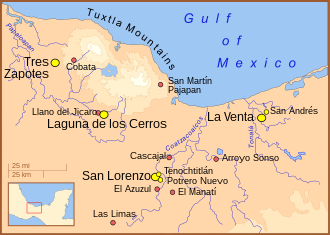
Tres Zapotes is a Mesoamerican archaeological site located in the south-central Gulf Lowlands of Mexico in the Papaloapan River plain. Tres Zapotes is sometimes referred to as the third major Olmec capital, but the Olmec phase is only a portion of the site's history, which continued through the Epi-Olmec and Classic Veracruz cultural periods.
People
Economy
Climate
| Population | 3,464 |
| Population Density | 19 / sq mi |
| Elevation | 95 ft (29 m) |
| Coordinates | 18.4671°, -95.4382° |
| Timezone | America/Mexico_City |
| Country | 🇲🇽 Mexico |
| State / Province | Veracruz |
| Average Temperature | 79°F (26°C) |
| January Average | 73°F (23°C) |
| July Average | 81°F (27°C) |
| Annual Precipitation | 41.4 inches (1,051 mm) |
| Annual Snowfall | 0.0 inches (0 cm) |
About Tres Zapotes
Tres Zapotes is a small town in Mexico (Veracruz) with a population of 3,464. The city sits at an elevation of 95 feet (29 meters) above sea level. The average annual temperature is 79°F (26°C). Temperatures range from 73°F in January to 81°F in July. Annual precipitation averages 41.4 inches. The timezone is America/Mexico_City.
Income: Tres Zapotes vs Mexico
Commute Mode
Income
Employment & Poverty
| Unemployment | 2.2% |
| 39% below Mexico avg | |
| Establishments (County) | 111 |
Business (County)
Tax & Cost of Living
Commute & Transportation
Walkability
Temperature
| Annual Average | 78.9°F |
| 46% above Mexico avg | |
| January Average | 73°F (23°C) |
| July Average | 81°F (27°C) |
| Sunny Days | 314 days/yr |
Geography
| Elevation | 95 ft (29 m) |
| Area | 178.5 sq mi (462.3 km²) |
| Population Density | 19/sq mi |
| Coordinates | 18.4671°N, 95.4382°W |
| Timezone | America/Mexico_City |
Precipitation & Snow
Air Quality
Nearby Volcanoes
2 volcanoes within 200 km. Closest: San Martin (28 km).
| Name | Type | Elevation | Last Eruption | Distance |
| San Martin | Shield | 1,650 m (5,413 ft) | 1796 | 28 km |
| Naolinco Volcanic Field | Pyroclastic cone(s) | 2,000 m (6,562 ft) | -1200 | 192 km |
Monthly Weather
| Month | Avg Temperature | Precipitation | Summary |
|---|---|---|---|
| January | 73°F (23°C) | 2.0 in | |
| February | 73°F (23°C) | 1.2 in | Coldest |
| March | 77°F (25°C) | 0.8 in | Driest |
| April | 81°F (27°C) | 1.1 in | |
| May | 84°F (29°C) | 2.0 in | Warmest |
| June | 83°F (28°C) | 8.0 in | |
| July | 81°F (27°C) | 10.4 in | |
| August | 81°F (27°C) | 10.4 in | |
| September | 81°F (27°C) | 13.8 in | Wettest |
| October | 78°F (26°C) | 10.8 in | |
| November | 76°F (24°C) | 5.4 in | |
| December | 73°F (23°C) | 3.7 in |
Tres Zapotes has a seasonal temperature swing of 12°F / from 73°F in February to 84°F in May. Total annual precipitation is 69.6 inches, with September being the wettest month (13.8") and March the driest (0.8").
Radio Stations near Tres Zapotes
2 stations within ~55 km.
| Station | Genre | Quality | |
|---|---|---|---|
| LA KEBUENA 103.9 (San Andrés Tuxtla) - 103.9 FM - XHDQ-FM - Quatro Media - San Andrés Tuxtla, Veracruz | 103.9 fm, américa | MP3 128 kbps | |
| MEZKLA FM 104.7 (San Andrés Tuxtla) - 104.7 FM - XHPTLA-FM - Grupo Mezkla - San Andrés Tuxtla, Veracruz | 104.7 fm, américa | MP3 |
Museums in Tres Zapotes
| Name | Type | Address | Phone | Annual Revenue |
|---|---|---|---|---|
| Casa de Cultura "Fernando Bustamante" | ||||
| Museo de la Ciudad | ||||
| Museo Regional | ||||
| Museo Regional Tuxtleco | ||||
| Museo Salvador Ferrando | ||||
| Museo Tres Zapotes |
Libraries in Tres Zapotes
| Name | Address | Staff | Annual Visits | Circulation | Collection | Programs |
|---|---|---|---|---|---|---|
| Biblioteca Pública | 0.0 |
Farmers Markets in Tres Zapotes
| Name | Address | Season | Hours | Organic | Website |
|---|---|---|---|---|---|
| Mercado Municipal | |||||
| Mercado Municipal | |||||
| Mercado Teodoro A. Dehesa | |||||
| Plaza Juárez |
Stadiums & Teams in Tres Zapotes
| Team | League | Division |
|---|---|---|
Airports Near Tres Zapotes
13 airports within the area.
| Airport | IATA | Type |
|---|---|---|
| Aeródromo Toro Bravo | — | Small Airport |
| Air Station No. 8 Loma Bonita | — | Small Airport |
| El Amate Airport | — | Small Airport |
| El Cubilete Airport | — | Small Airport |
| El Zopilote Airport | — | Small Airport |
| General Miguel Alemán Airport | — | Small Airport |
| Jalisquillo Airport | — | Small Airport |
| La Esmeralda Airstrip | — | Small Airport |
| Los Tuxtlas Regional Airport | — | Small Airport |
| Marina Heroica Naval Academy Airfield | — | Small Airport |
| Pista Macuiles | — | Small Airport |
| San Jose Independencia Airstrip | — | Small Airport |
| Tres Encinos Airport | — | Small Airport |
Quick Facts
🇲🇽 About Mexico
Public Holidays in Mexico
9 public holidays this year
Download Full City Report
Get a comprehensive, print-ready PDF with all data for Tres Zapotes.
Get ReportFrequently Asked Questions About Tres Zapotes
What is the population of Tres Zapotes?
Tres Zapotes has a population of 3,464 residents and is located in Mexico. The population density is 19 people per square mile, spread across 178.5 square miles.
What is the weather like in Tres Zapotes?
Tres Zapotes has a warm climate with an average annual temperature of 79°F (26°C). Winter temperatures average 73°F in January, while summers reach an average of 81°F in July. The area receives 314 sunny days per year, well above the national average of 205. Annual rainfall totals 41.4 inches.
How is the job market in Tres Zapotes?
The job market in Tres Zapotes is very strong, with unemployment at just 2.2% / well below the national rate of 3.6%. There are 111 business establishments in the area.